MyTopo
Oklahoma City SW Oklahoma US Topo Map
Couldn't load pickup availability
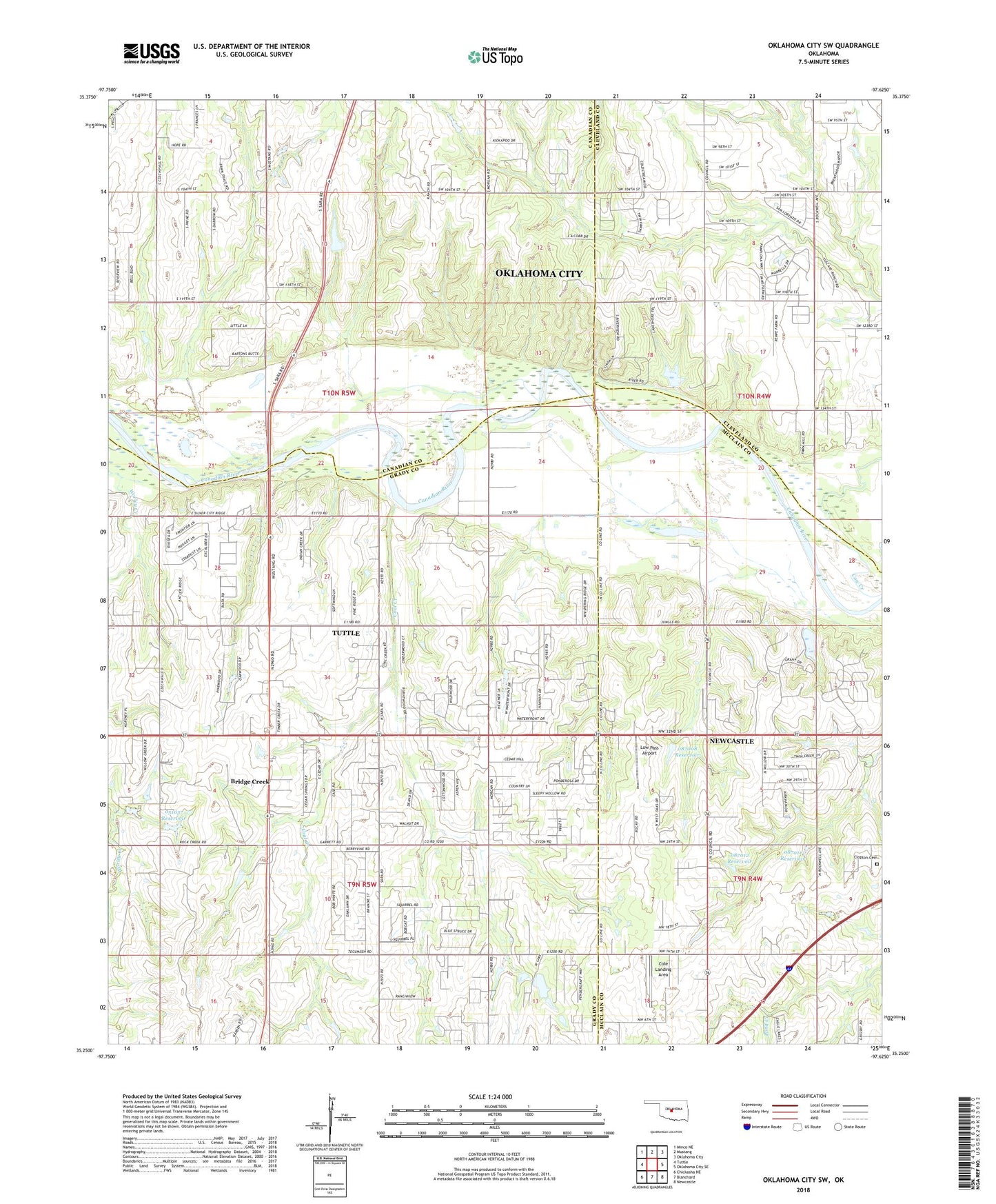
2022 topographic map quadrangle Oklahoma City SW in the state of Oklahoma. Scale: 1:24000. Based on the newly updated USGS 7.5' US Topo map series, this map is in the following counties: Grady, Canadian, McClain, Cleveland. The map contains contour data, water features, and other items you are used to seeing on USGS maps, but also has updated roads and other features. This is the next generation of topographic maps. Printed on high-quality waterproof paper with UV fade-resistant inks.
Quads adjacent to this one:
West: Tuttle
Northwest: Minco NE
North: Mustang
Northeast: Oklahoma City
East: Oklahoma City SE
Southeast: Newcastle
South: Blanchard
Southwest: Chickasha NE
This map covers the same area as the classic USGS quad with code o35097c6.
Contains the following named places: Camp Kickapoo, Clopton Cemetery, Coal Creek, Cole Landing Area, Cow Creek, East Creek, Low Pass Airport, Oknoname 051037 Dam, Oknoname 051037 Reservoir, Oknoname 087008 Dam, Oknoname 087008 Reservoir, Oknoname 087011 Dam, Oknoname 087011 Reservoir, Oknoname 087012 Dam, Oknoname 087012 Reservoir, Pentecostal Campground, Quincy Post Office, Snow Hill Church, Timberlake Dam, Timberlake Reservoir, Worley Creek, ZIP Codes: 73064, 73173