MyTopo
Panama Oklahoma US Topo Map
Couldn't load pickup availability
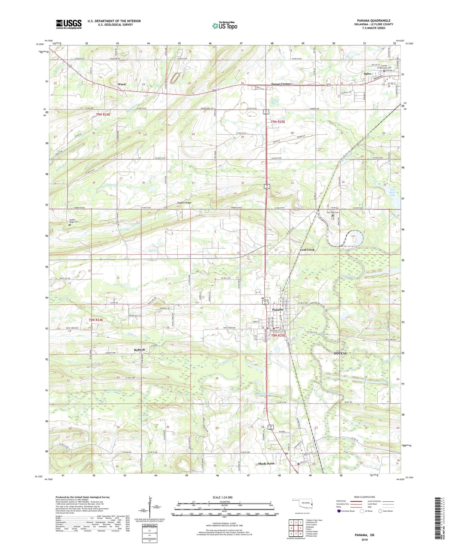
2022 topographic map quadrangle Panama in the state of Oklahoma. Scale: 1:24000. Based on the newly updated USGS 7.5' US Topo map series, this map is in the following counties: Le Flore. The map contains contour data, water features, and other items you are used to seeing on USGS maps, but also has updated roads and other features. This is the next generation of topographic maps. Printed on high-quality waterproof paper with UV fade-resistant inks.
Quads adjacent to this one:
West: Bokoshe
Northwest: Robert S Kerr Dam
North: Muldrow SW
Northeast: Fort Coffee
East: Spiro
Southeast: Poteau East
South: Poteau West
Southwest: Potato Peaks
This map covers the same area as the classic USGS quad with code o35094b6.
Contains the following named places: Bedwell, Bennington Church, Brazil Creek, Buck Creek, Carter Lake, Coal Creek, Fairview Cemetery, First Assembly of God, Flower Hill Church, Flower Hill School, James Fork, Kiamichi Technology Center Spiro, Nubbin Ridge Cemetery, Panama, Panama Elementary School, Panama Fire Department, Panama High School, Panama Middle School, Panama Police Department, Panama Post Office, Shady Point, Shady Point Elementary School, Shady Point Fire Department, Shady Point Police Department, Shady Point Post Office, Spiro City Cemetery, Spiro Elementary School, Spiro High School, Spiro Middle School, Sunset Corner, Swink Lake, Swink Lake Dam, Town of Panama, Town of Shady Point, Township of Shady Point, Ward, ZIP Code: 74951