MyTopo
Boynton Oklahoma US Topo Map
Couldn't load pickup availability
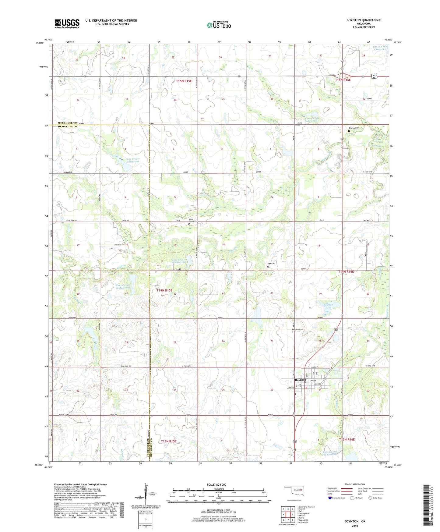
2018 topographic map quadrangle Boynton in the state of Oklahoma. Scale: 1:24000. Based on the newly updated USGS 7.5' US Topo map series, this map is in the following counties: Muskogee, Okmulgee. The map contains contour data, water features, and other items you are used to seeing on USGS maps, but also has updated roads and other features. This is the next generation of topographic maps. Printed on high-quality waterproof paper with UV fade-resistant inks.
Quads adjacent to this one:
West: Okmulgee NE
Northwest: Concharty Mountain
North: Haskell
Northeast: Taft
East: Beland
Southeast: Wainwright
South: Council Hill
Southwest: Morris
Contains the following named places: Boynton, Boynton - Moton Elementary School, Boynton - Moton High School, Boynton Cemetery, Boynton Division, Boynton Lake, Boynton Lake Dam, Boynton Post Office, Boynton Volunteer Fire Department, Cane Creek, Cane Creek Cemetery, Cane Creek Church, Cane Creek Site 18 Dam, Cane Creek Site 18 Reservoir, Cane Creek Site 19 Dam, Cane Creek Site 19 Reservoir, Cane Creek Site 2 Dam, Cane Creek Site 2 Reservoir, Cane Creek Site 20 Dam, Cane Creek Site 20 Reservoir, Cane Creek Site 21 Dam, Cane Creek Site 21 Reservoir, Cane Creek Site 22 Dam, Cane Creek Site 22 Reservoir, Cane Creek Site 26a Dam, Cane Creek Site 26a Reservoir, Cane Creek Site 5 Dam, Cane Creek Site 5 Reservoir, Charles Cemetery, Coal Creek Church, Lee Cemetery, Town of Boynton, Township of Sutton, Walnut Creek