MyTopo
Taft Oklahoma US Topo Map
Couldn't load pickup availability
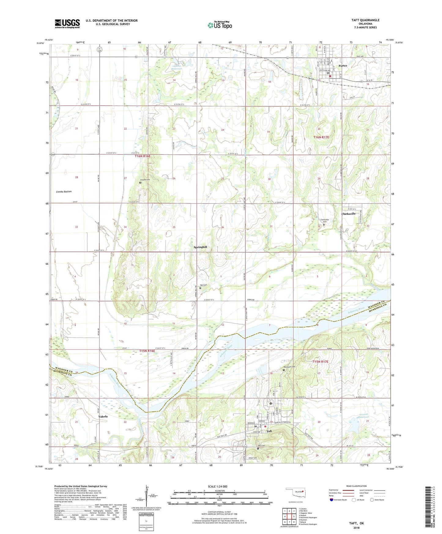
2022 topographic map quadrangle Taft in the state of Oklahoma. Scale: 1:24000. Based on the newly updated USGS 7.5' US Topo map series, this map is in the following counties: Wagoner, Muskogee. The map contains contour data, water features, and other items you are used to seeing on USGS maps, but also has updated roads and other features. This is the next generation of topographic maps. Printed on high-quality waterproof paper with UV fade-resistant inks.
Quads adjacent to this one:
West: Haskell
Northwest: Coweta
North: Red Bird
Northeast: Wagoner West
East: Northwest Muskogee
Southeast: Southwest Muskogee
South: Beland
Southwest: Boynton
This map covers the same area as the classic USGS quad with code o35095g5.
Contains the following named places: Blackjack Cemetery, Blackjack Church, Blue Creek, Choska Bottom, Choska Cemetery, Clarksville, Clarksville Cemetery, Clarksville Census Designated Place, Cloud Creek, Cummings-Cole CME, Doctor Eddie Warrior Correctional Center, George Nigh Staff Development Center, Jess Dunn Correctional Center, Oknoname 101008 Dam, Oknoname 101008 Reservoir, Oknoname 145004 Dam, Oknoname 145004 Reservoir, Porter, Porter Consolidated High School, Porter Consolidated Schools, Porter Police Department, Porter Post Office, Porter Volunteer Fire Department, Saint Paul Baptist Church, South Wagoner Division, Springhill, Stones Corner, Taft, Taft Cemetery, Taft Fire Association, Taft Post Office, Town of Porter, Town of Taft, Township of Gatesville, Township of Porter, Vann Cemetery, Yahola, Yellow Water Ditch, ZIP Codes: 74454, 74463