MyTopo
Beland Oklahoma US Topo Map
Couldn't load pickup availability
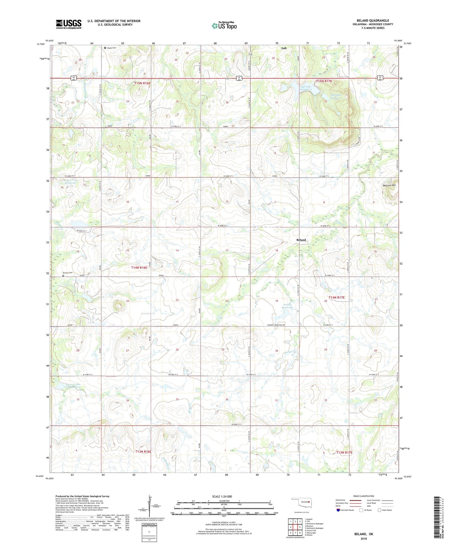
2022 topographic map quadrangle Beland in the state of Oklahoma. Scale: 1:24000. Based on the newly updated USGS 7.5' US Topo map series, this map is in the following counties: Muskogee. The map contains contour data, water features, and other items you are used to seeing on USGS maps, but also has updated roads and other features. This is the next generation of topographic maps. Printed on high-quality waterproof paper with UV fade-resistant inks.
Quads adjacent to this one:
West: Boynton
Northwest: Haskell
North: Taft
Northeast: Northwest Muskogee
East: Southwest Muskogee
Southeast: Oktaha
South: Wainwright
Southwest: Council Hill
This map covers the same area as the classic USGS quad with code o35095f5.
Contains the following named places: Baucum Hill, Beland, Brown Cemetery, Cane Creek 29 Reservoir, Cane Creek Site 27 Dam, Cane Creek Site 27 Reservoir, Cane Creek Site 29 Dam, Cloud Creek Church, Doyle Cemetery, Flusche, Mount Pleasant Church, Muskogee Southwest Division, Oknoname 101003 Dam, Oknoname 101003 Reservoir, Taft Institution Lake, Taft Lake Number 1, Taft Lake Number 1 Dam, Taft Lake Number 2, Taft Lake Number 2 Dam, Taft Lake Number 3, Taft Lake Number 3 Dam, Wilson Chapel