MyTopo
Wainwright Oklahoma US Topo Map
Couldn't load pickup availability
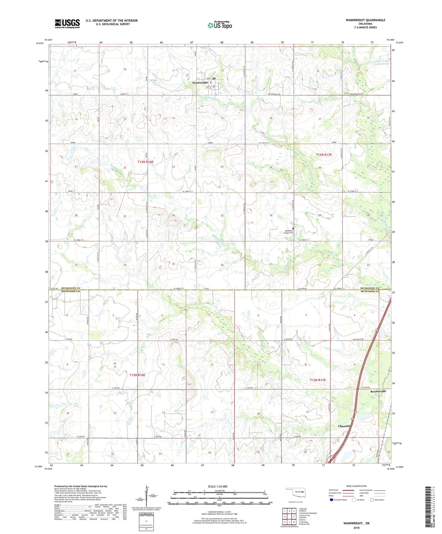
2022 topographic map quadrangle Wainwright in the state of Oklahoma. Scale: 1:24000. Based on the newly updated USGS 7.5' US Topo map series, this map is in the following counties: Muskogee, McIntosh. The map contains contour data, water features, and other items you are used to seeing on USGS maps, but also has updated roads and other features. This is the next generation of topographic maps. Printed on high-quality waterproof paper with UV fade-resistant inks.
Quads adjacent to this one:
West: Council Hill
Northwest: Boynton
North: Beland
Northeast: Southwest Muskogee
East: Oktaha
Southeast: Warner NW
South: Checotah
Southwest: Pierce
This map covers the same area as the classic USGS quad with code o35095e5.
Contains the following named places: Cane Creek Site 24 Dam, Cane Creek Site 24 Reservoir, Koch Airport, Middleton Chapel Cemetery, Oak-Ta-Hah, Town of Wainwright, Township of Brown, Wainwright, Wainwright Elementary School, Wainwright Fire Department, Wainwright Post Office, ZIP Code: 74468