MyTopo
Geary South Oklahoma US Topo Map
Couldn't load pickup availability
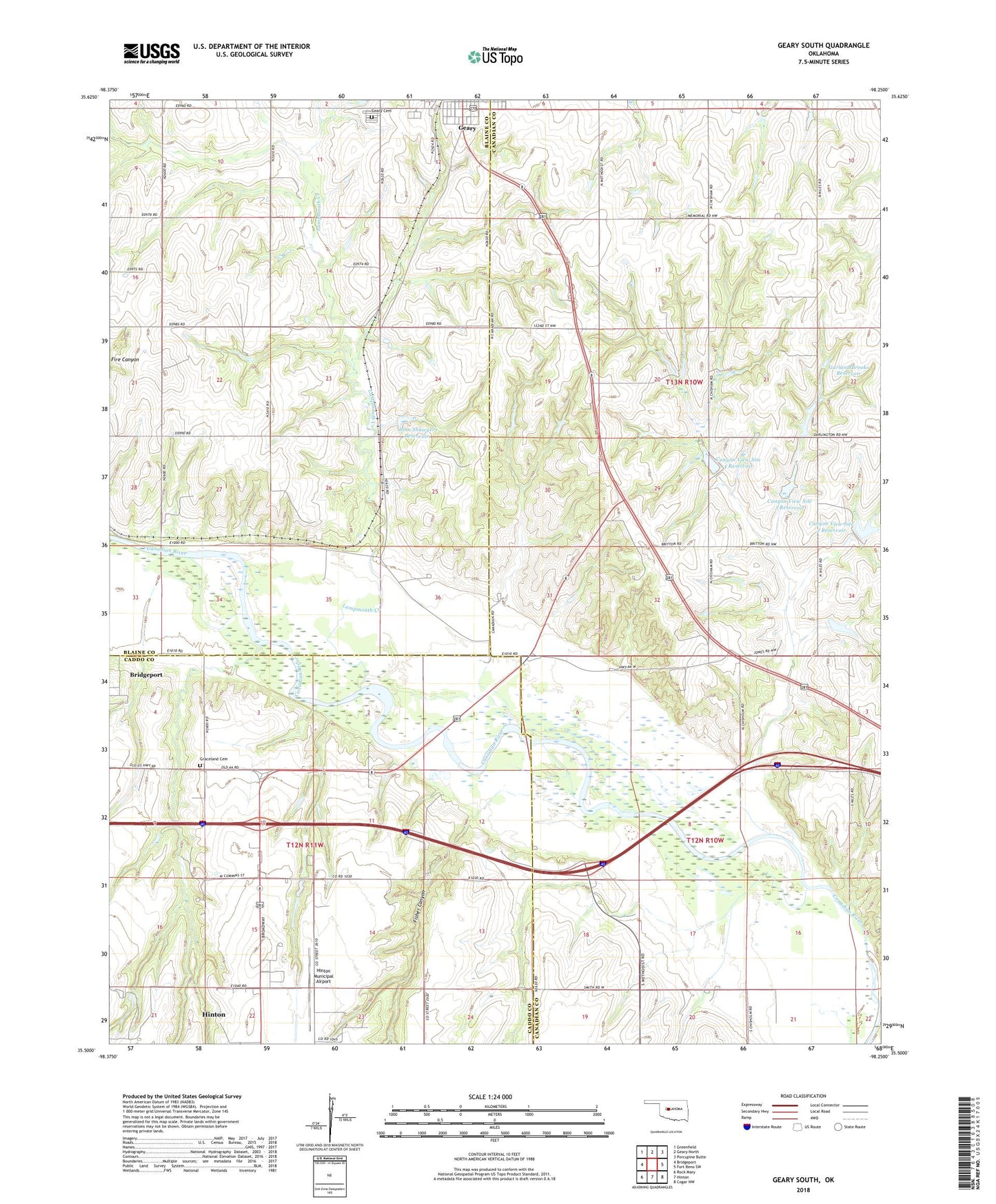
2022 topographic map quadrangle Geary South in the state of Oklahoma. Scale: 1:24000. Based on the newly updated USGS 7.5' US Topo map series, this map is in the following counties: Canadian, Blaine, Caddo. The map contains contour data, water features, and other items you are used to seeing on USGS maps, but also has updated roads and other features. This is the next generation of topographic maps. Printed on high-quality waterproof paper with UV fade-resistant inks.
Quads adjacent to this one:
West: Bridgeport
Northwest: Greenfield
North: Geary North
Northeast: Porcupine Butte
East: Fort Reno SW
Southeast: Cogar NW
South: Hinton
Southwest: Rock Mary
This map covers the same area as the classic USGS quad with code o35098e3.
Contains the following named places: Canyon View School, Canyon View Site 1 Dam, Canyon View Site 1 Reservoir, Canyon View Site 2 Dam, Canyon View Site 2 Reservoir, Canyon View Site 3 Dam, Canyon View Site 3 Reservoir, Canyon View Site 4 Dam, Canyon View Site 4 Reservoir, City of Geary, Fairview School, Fisher Canyon, Free Methodist Church, Garland Brooks Dam, Garland Brooks Reservoir, Geary Cemetery, Good Hope School, Graceland Cemetery, Hinton Municipal Airport, Independence School, John Shawyer Dam, John Shawyer Reservoir, Lumpmouth Creek, Riverview School, Township of Alfalfa, Township of Waconda, Victory School, Walnut Grove School