MyTopo
Geary North Oklahoma US Topo Map
Couldn't load pickup availability
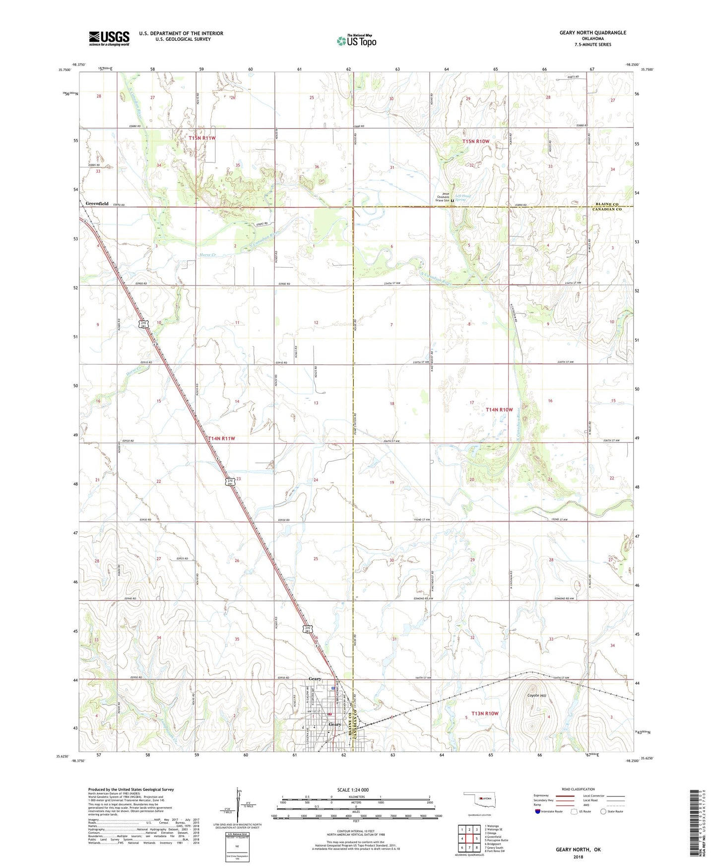
2022 topographic map quadrangle Geary North in the state of Oklahoma. Scale: 1:24000. Based on the newly updated USGS 7.5' US Topo map series, this map is in the following counties: Blaine, Canadian. The map contains contour data, water features, and other items you are used to seeing on USGS maps, but also has updated roads and other features. This is the next generation of topographic maps. Printed on high-quality waterproof paper with UV fade-resistant inks.
Quads adjacent to this one:
West: Greenfield
Northwest: Watonga
North: Watonga SE
Northeast: Omega
East: Porcupine Butte
Southeast: Fort Reno SW
South: Geary South
Southwest: Bridgeport
This map covers the same area as the classic USGS quad with code o35098f3.
Contains the following named places: All-Tribes Community Church, Baptist Indian Cemetery, Cheyenne and Arapahoe District 3, Christian Church Disciples, Church of Christ, Church of God, Coyote Hill, First Baptist Church, First Mennonite Church, First United Methodist Church, Geary, Geary Elementary School, Geary Emergency Medical Service, Geary Fire Department, Geary High School, Geary Junior High School, Geary Police Department, Geary Post Office, Geary Rural Fire and Rescue, Grandview Church, Horse Creek, Jesse Chisholm Grave Site, Left Hand Spring, Macedonia Baptist Church, Township of Canadian, Township of Valley