MyTopo
Brooksville Oklahoma US Topo Map
Couldn't load pickup availability
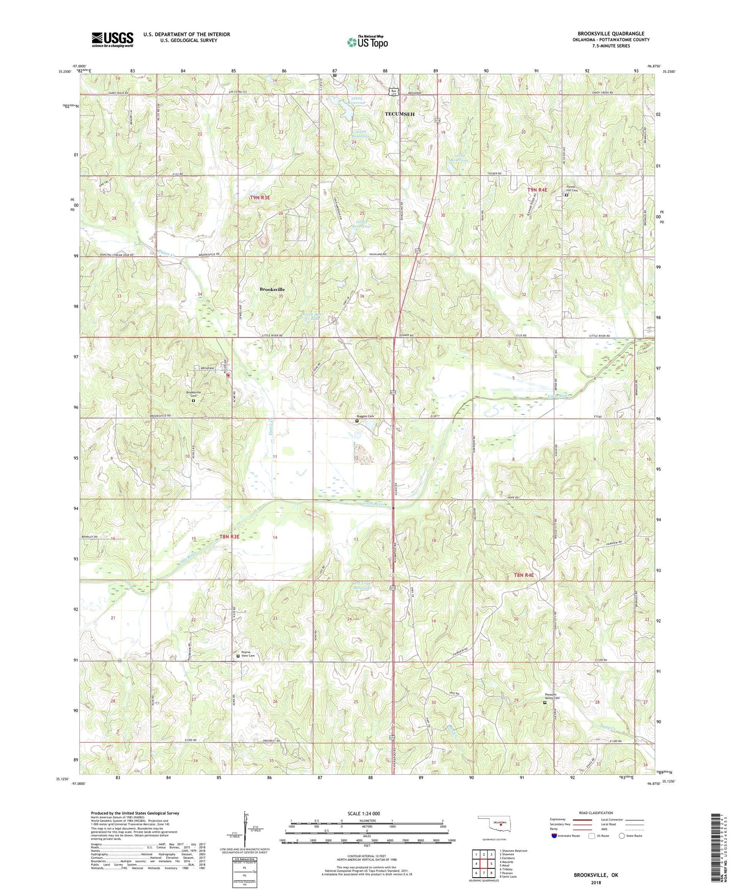
2018 topographic map quadrangle Brooksville in the state of Oklahoma. Scale: 1:24000. Based on the newly updated USGS 7.5' US Topo map series, this map is in the following counties: Pottawatomie. The map contains contour data, water features, and other items you are used to seeing on USGS maps, but also has updated roads and other features. This is the next generation of topographic maps. Printed on high-quality waterproof paper with UV fade-resistant inks.
Quads adjacent to this one:
West: Macomb
Northwest: Shawnee Reservoir
North: Shawnee
Northeast: Earlsboro
East: Maud
Southeast: Saint Louis
South: Pearson
Southwest: Tribbey
Contains the following named places: Audrey Crown Dam, Audrey Crown Reservoir, Brooksville, Brooksville Cemetery, Brooksville Volunteer Fire Department, Chisney, Dance Creek, E T Cope Dam, E T Cope Reservoir, Fairview Church, Forest Hill Cemetery, Glen Nix Dam, Glen Nix Reservoir, Holiness Church Camp, Jesse McGaha Dam, Jesse McGaha Reservoir, Macomb-Y, North Deer Creek Lake, Oknoname 12501 Dam, Oknoname 12501 Reservoir, Oknoname 12502 Dam, Oknoname 12502 Reservoir, Oknoname 12503 Dam, Oknoname 12503 Reservoir, Oknoname 12504 Dam, Oknoname 12504 Reservoir, Oknoname 12505 Dam, Oknoname 12505 Reservoir, Oknoname 12506 Dam, Oknoname 12506 Reservoir, Pleasant Valley Cemetery, Pottawatomie County, Prairie View Cemetery, Ruggles Cemetery, Town of Brooksville, Township of Forest, Township of Moore, ZIP Code: 74873