MyTopo
Shawnee Reservoir Oklahoma US Topo Map
Couldn't load pickup availability
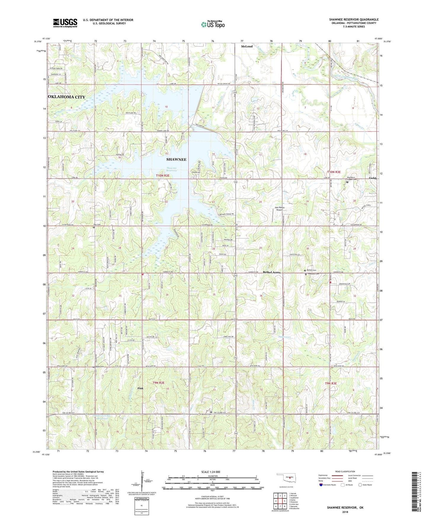
2022 topographic map quadrangle Shawnee Reservoir in the state of Oklahoma. Scale: 1:24000. Based on the newly updated USGS 7.5' US Topo map series, this map is in the following counties: Pottawatomie. The map contains contour data, water features, and other items you are used to seeing on USGS maps, but also has updated roads and other features. This is the next generation of topographic maps. Printed on high-quality waterproof paper with UV fade-resistant inks.
Quads adjacent to this one:
West: Stella
Northwest: Harrah
North: McLoud
Northeast: Aydelotte
East: Shawnee
Southeast: Brooksville
South: Macomb
Southwest: Little Axe
This map covers the same area as the classic USGS quad with code o35097c1.
Contains the following named places: Bethel Acres, Bethel Acres Fire Department Station 1, Bethel Acres Fire Department Station 2, Bethel Church, Bethel Elementary School, Bethel High School, Bethel Middle School, Bethel United Methodist Church Cemetery, Black Cemetery, Blackburn Chapel, Blackburn Chapel Cemetery, Brown Cemetery, Centerpoint Oil Field, Gaddy, Hopewell Cemetery, Hopewell Church, Jazz Ranch Airport, Longbranch Site 4 Dam, Longbranch Site 4 Reservoir, Newhope School, North Deer Creek, Pink, Ray Cemetery, Shawnee City Lake Number 1, Shawnee City Lake Number 1 Dam, Shawnee City Lake Number 2, Shawnee City Lake Number 2 Dam, Shawnee Reservoir, Town of Bethel Acres, Township of Brinton