MyTopo
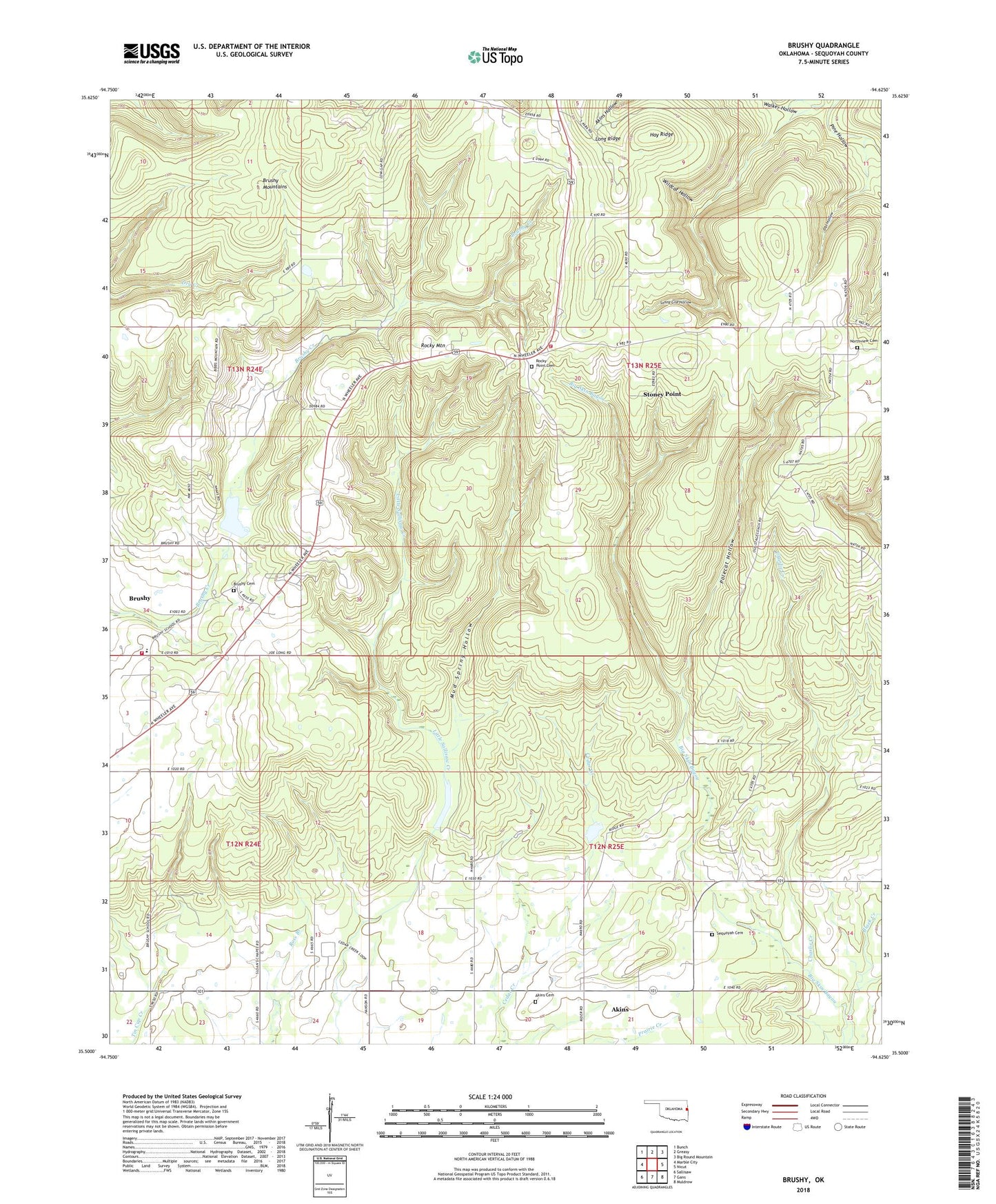
Brushy Oklahoma US Topo Map
Couldn't load pickup availability
2022 topographic map quadrangle Brushy in the state of Oklahoma. Scale: 1:24000. Based on the newly updated USGS 7.5' US Topo map series, this map is in the following counties: Sequoyah. The map contains contour data, water features, and other items you are used to seeing on USGS maps, but also has updated roads and other features. This is the next generation of topographic maps. Printed on high-quality waterproof paper with UV fade-resistant inks.
Quads adjacent to this one:
West: Marble City
Northwest: Bunch
North: Greasy
Northeast: Big Round Mountain
East: Nicut
Southeast: Muldrow
South: Gans
Southwest: Sallisaw
This map covers the same area as the classic USGS quad with code o35094e6.
Contains the following named places: Akins, Akins Cemetery, Akins Census Designated Place, Brushy, Brushy Cemetery, Brushy Census Designated Place, Brushy Elementary School, Brushy Lake, Brushy Mountain Volunteer Fire Department Sequoyah County, Brushy Mountains, Charlie Creek, Hay Ridge, Home of Sequoyah, Long Ridge, Mud Spring Hollow, Northview Cemetery, Obi Hollow, Polecat Hollow, Rocky Mountain, Rocky Point Cemetery, Rocky Point Church, Rocky Point Fire Department, Sallisaw Creek Site 22 Dam, Sallisaw Creek Site 22 Reservoir, Sallisaw Creek Site 30 Dam, Sallisaw Creek Site 36 Dam, Sallisaw Creek Site 36 Reservoir, Sallisaw Creek Site 37 Dam, Sallisaw Creek Site 37 Reservoir, Sallisaw North Division, Sequoyah Cemetery, Sequoyah Non-Community, Stoney Point, Stoney Point Census Designated Place, Township of Prices Chapel, Township of Rocky Mountain, Walker Hollow, Wildcat Hollow