MyTopo
Cogar NE Oklahoma US Topo Map
Couldn't load pickup availability
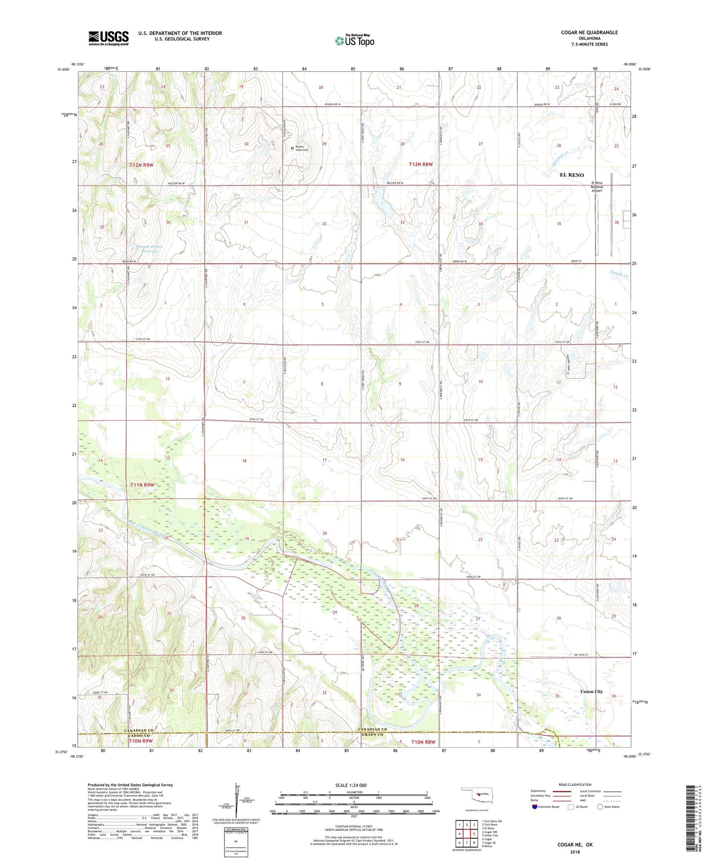
2022 topographic map quadrangle Cogar NE in the state of Oklahoma. Scale: 1:24000. Based on the newly updated USGS 7.5' US Topo map series, this map is in the following counties: Canadian, Grady, Caddo. The map contains contour data, water features, and other items you are used to seeing on USGS maps, but also has updated roads and other features. This is the next generation of topographic maps. Printed on high-quality waterproof paper with UV fade-resistant inks.
Quads adjacent to this one:
West: Cogar NW
Northwest: Fort Reno SW
North: Fort Reno
Northeast: El Reno
East: Union City
Southeast: Minco
South: Cogar SE
Southwest: Cogar
This map covers the same area as the classic USGS quad with code o35098d1.
Contains the following named places: Buena Vista Cemetery, Dave Richardson Number 1 Dam, Dave Richardson Number 1 Reservoir, El Reno Regional Airport, Heaston Church, Township of Prairie, Wayne Reuter Dam, Wayne Reuter Reservoir