MyTopo
Fort Reno SW Oklahoma US Topo Map
Couldn't load pickup availability
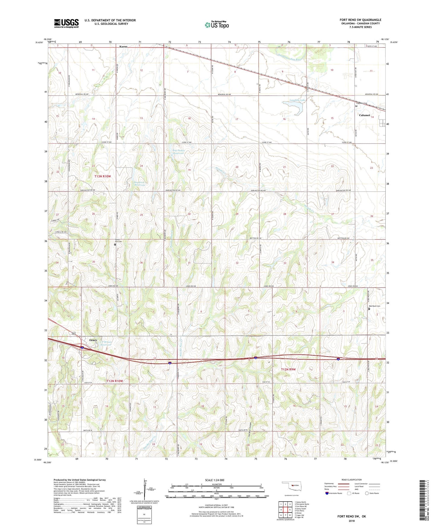
2022 topographic map quadrangle Fort Reno SW in the state of Oklahoma. Scale: 1:24000. Based on the newly updated USGS 7.5' US Topo map series, this map is in the following counties: Canadian. The map contains contour data, water features, and other items you are used to seeing on USGS maps, but also has updated roads and other features. This is the next generation of topographic maps. Printed on high-quality waterproof paper with UV fade-resistant inks.
Quads adjacent to this one:
West: Geary South
Northwest: Geary North
North: Porcupine Butte
Northeast: Fort Reno NE
East: Fort Reno
Southeast: Cogar NE
South: Cogar NW
Southwest: Hinton
This map covers the same area as the classic USGS quad with code o35098e2.
Contains the following named places: Calumet Cemetery, Deep Dale Church, Headrick 1 Dam, Headrick 1 Reservoir, J P Wilson Dam, J P Wilson Reservoir, Karns, Laughlin Lake, Maberry Dam, Maberry Reservoir, Maple Elementary School, Red Rock Cemetery, Red Rock United Methodist Church, Roy Stokes Dam, Roy Stokes Reservoir, Sunny Hill Cemetery, Township of Calumet, West Canadian Division, ZIP Code: 73014