MyTopo
Cowden Oklahoma US Topo Map
Couldn't load pickup availability
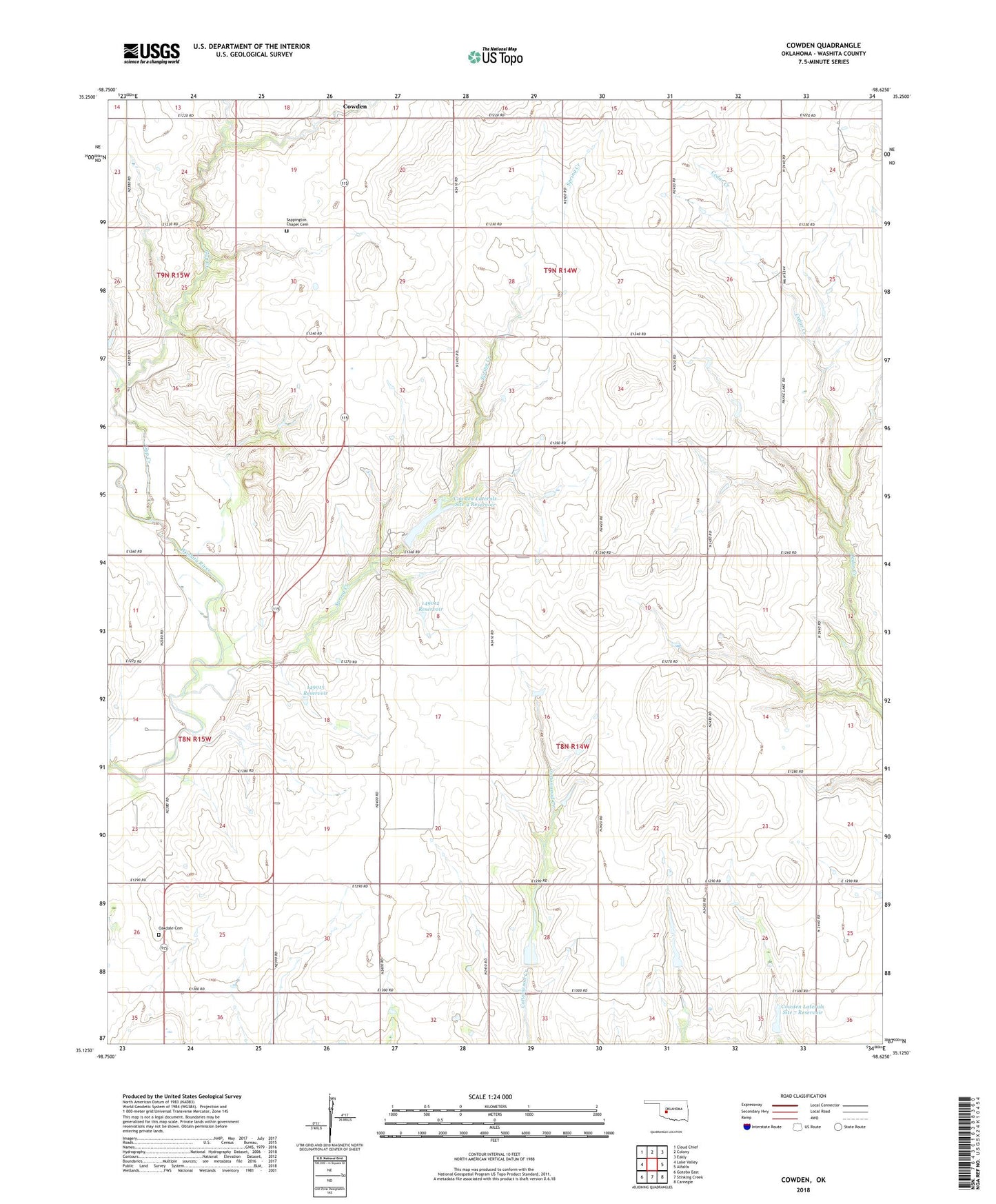
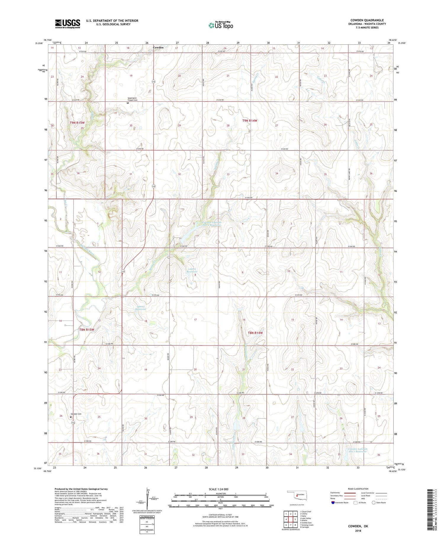
2018 topographic map quadrangle Cowden in the state of Oklahoma. Scale: 1:24000. Based on the newly updated USGS 7.5' US Topo map series, this map is in the following counties: Washita. The map contains contour data, water features, and other items you are used to seeing on USGS maps, but also has updated roads and other features. This is the next generation of topographic maps. Printed on high-quality waterproof paper with UV fade-resistant inks.
Quads adjacent to this one:
West: Lake Valley
Northwest: Cloud Chief
North: Colony
Northeast: Eakly
East: Alfalfa
Southeast: Carnegie
South: Stinking Creek
Southwest: Gotebo East
Contains the following named places: Cavalry Creek Site 1 Dam, Cavalry Creek Site 1 Reservoir, Cavalry Creek Site 2 Dam, Cavalry Creek Site 2 Reservoir, Cowden, Cowden Laterals Site 3 Dam, Cowden Laterals Site 3 Reservoir, Cowden Laterals Site 4 Dam, Cowden Laterals Site 4 Reservoir, Cowden Laterals Site 5 Dam, Cowden Laterals Site 5 Reservoir, Cowden Laterals Site 6 Dam, Cowden Laterals Site 6 Reservoir, Cowden Laterals Site 7 Dam, Cowden Laterals Site 7 Reservoir, Gyp Creek, Ionine Creek Site 102 Dam, Ionine Creek Site 102 Reservoir, Mount Vernon Church, New Harmony Church, Oakdale Cemetery, Oknoname 149012 Dam, Oknoname 149012 Reservoir, Oknoname 149015 Dam, Oknoname 149015 Reservoir, Oknoname 149039 Dam, Oknoname 149039 Reservoir, Sappington Chapel, Sappington Chapel Cemetery, Spring Creek, Township of Oakdale