MyTopo
Stinking Creek Oklahoma US Topo Map
Couldn't load pickup availability
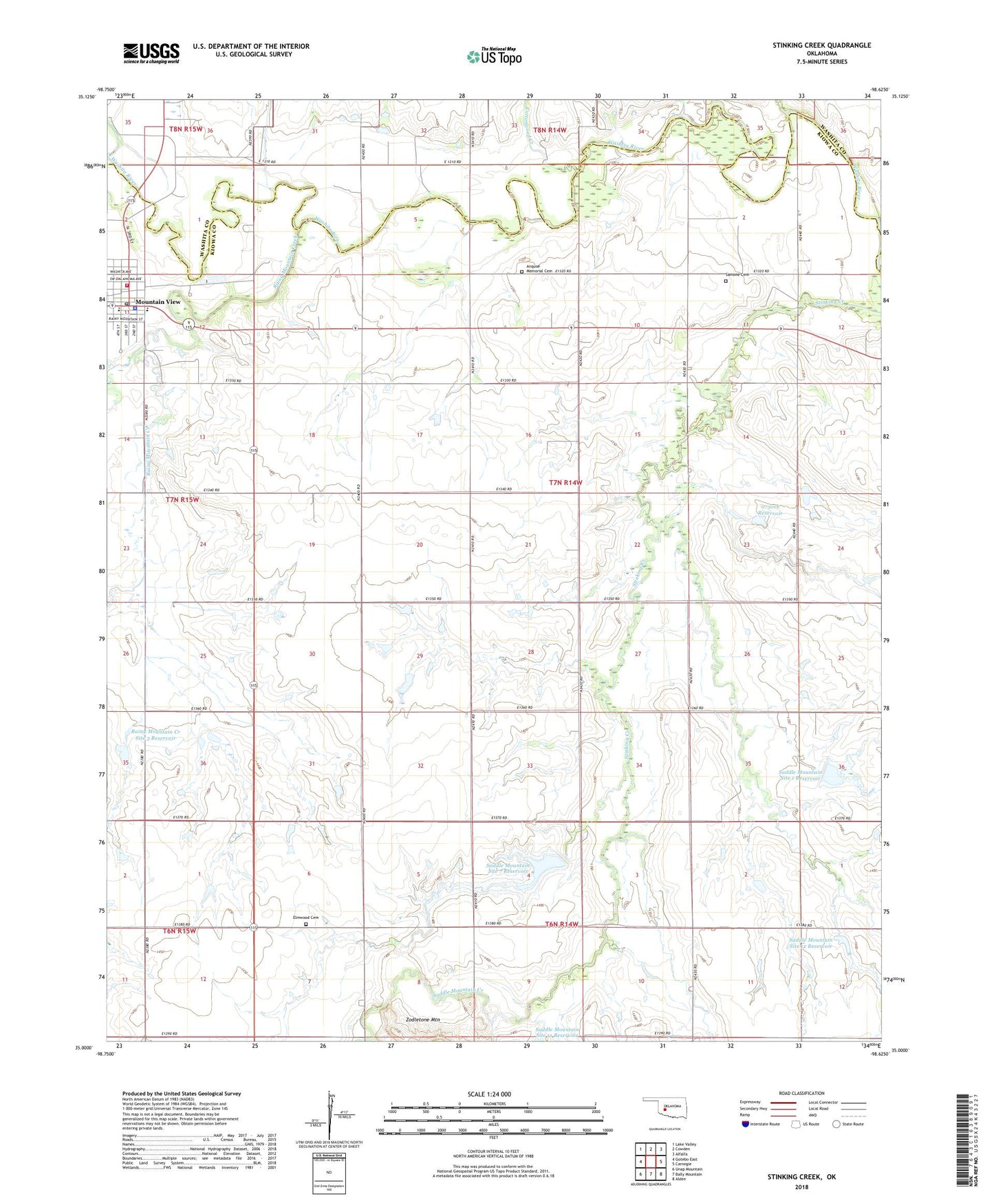
2022 topographic map quadrangle Stinking Creek in the state of Oklahoma. Scale: 1:24000. Based on the newly updated USGS 7.5' US Topo map series, this map is in the following counties: Kiowa, Washita. The map contains contour data, water features, and other items you are used to seeing on USGS maps, but also has updated roads and other features. This is the next generation of topographic maps. Printed on high-quality waterproof paper with UV fade-resistant inks.
Quads adjacent to this one:
West: Gotebo East
Northwest: Lake Valley
North: Cowden
Northeast: Alfalfa
East: Carnegie
Southeast: Alden
South: Bally Mountain
Southwest: Unap Mountain
This map covers the same area as the classic USGS quad with code o35098a6.
Contains the following named places: Anquoe Memorial Cemetery, Cedar Creek Landing Strip, Cottonwood Creek, Elmwood Cemetery, Little Red Church, Mountain View, Mountain View - Gotebo Elementary School, Mountain View - Gotebo High School, Mountain View Gotebo Ambulance, Mountain View Police Department, Mountain View Post Office, Mountain View Volunteer Fire Department, Oknoname 075016 Dam, Oknoname 075016 Reservoir, Pecan Creek, Rainy Mountain Creek, Rainy Mountain Creek Site 2 Dam, Rainy Mountain Creek Site 2 Reservoir, Rainy Mountain Creek Site 3 Dam, Rainy Mountain Creek Site 3 Reservoir, Saddle Countain Site 101 Reservoir, Saddle Mountain Creek, Saddle Mountain Site 1 Dam, Saddle Mountain Site 1 Reservoir, Saddle Mountain Site 101 Dam, Saddle Mountain Site 12 Dam, Saddle Mountain Site 12 Reservoir, Saddle Mountain Site 2 Dam, Saddle Mountain Site 2 Reservoir, Saddle Mountain Site 7 Dam, Saddle Mountain Site 7 Reservoir, Saddle Mountain Site 8 Dam, Saddle Mountain Site 8 Reservoir, Samone Cemetery, Samone Church, Town of Mountain View, Township of Mountain View, ZIP Code: 73062