MyTopo
Gotebo East Oklahoma US Topo Map
Couldn't load pickup availability
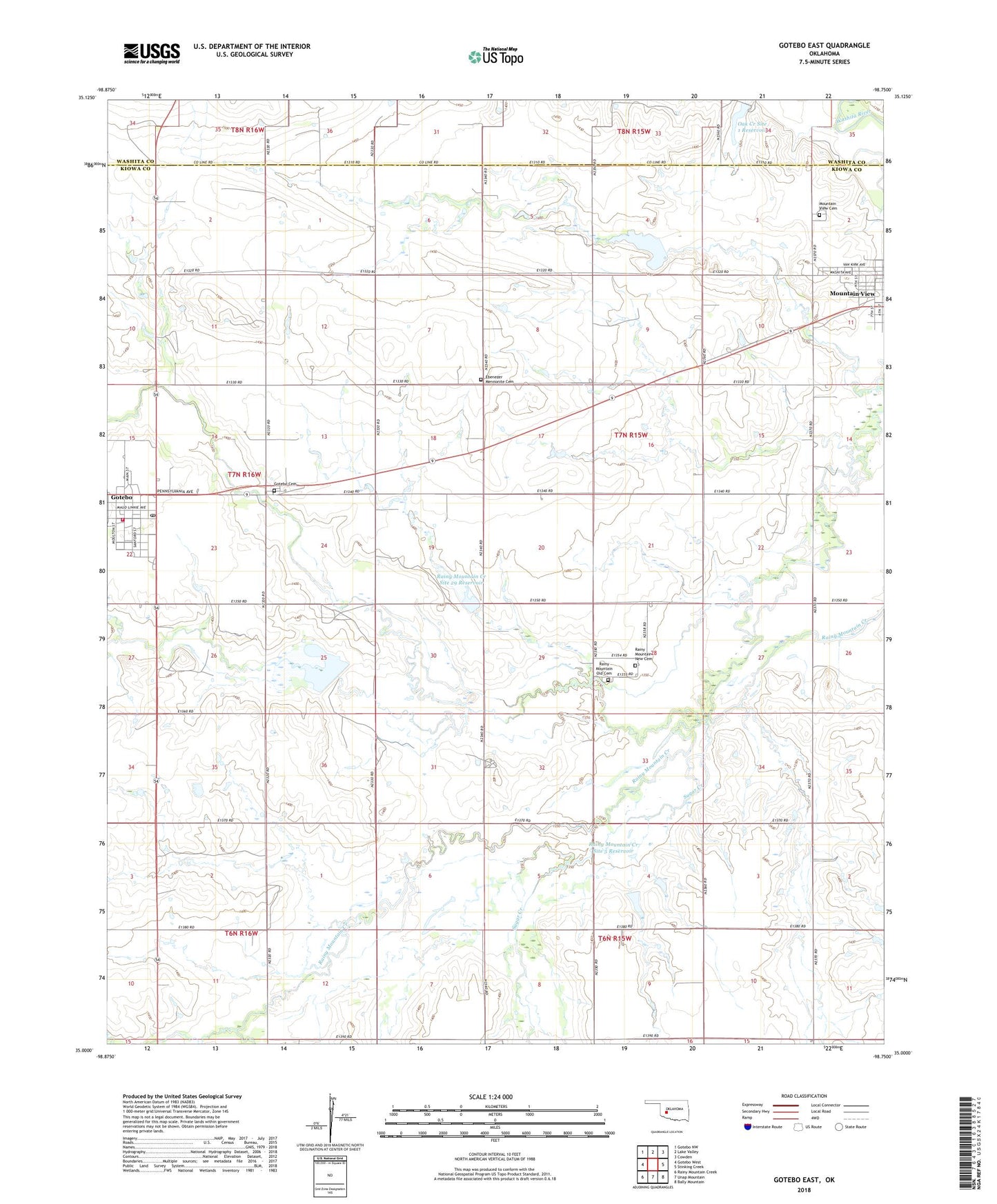
2022 topographic map quadrangle Gotebo East in the state of Oklahoma. Scale: 1:24000. Based on the newly updated USGS 7.5' US Topo map series, this map is in the following counties: Kiowa, Washita. The map contains contour data, water features, and other items you are used to seeing on USGS maps, but also has updated roads and other features. This is the next generation of topographic maps. Printed on high-quality waterproof paper with UV fade-resistant inks.
Quads adjacent to this one:
West: Gotebo West
Northwest: Gotebo NW
North: Lake Valley
Northeast: Cowden
East: Stinking Creek
Southeast: Bally Mountain
South: Unap Mountain
Southwest: Rainy Mountain Creek
This map covers the same area as the classic USGS quad with code o35098a7.
Contains the following named places: Ebenezer Church, Ebenezer Mennonite Cemetery, Gotebo, Gotebo Cemetery, Gotebo Fire Department, Gotebo Post Office, Lone Wolf Chapel, Mountain View Cemetery, Mountain View Division, Oak Creek Site 1 Dam, Oak Creek Site 1 Reservoir, Rainy Mountain Creek Site 29 Dam, Rainy Mountain Creek Site 29 Reservoir, Rainy Mountain Creek Site 38 Dam, Rainy Mountain Creek Site 38 Reservoir, Rainy Mountain Creek Site 5 Dam, Rainy Mountain Creek Site 5 Reservoir, Rainy Mountain Kiowa Indian Baptist Church, Rainy Mountain New Cemetery, Rainy Mountain Old Cemetery, Sugar Creek, Town of Gotebo, Township of Harrison