MyTopo
Duncan South Oklahoma US Topo Map
Couldn't load pickup availability
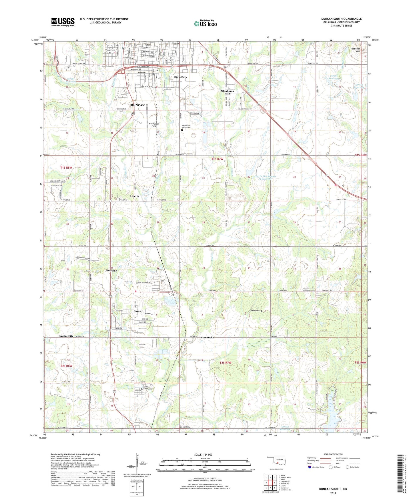
2022 topographic map quadrangle Duncan South in the state of Oklahoma. Scale: 1:24000. Based on the newly updated USGS 7.5' US Topo map series, this map is in the following counties: Stephens. The map contains contour data, water features, and other items you are used to seeing on USGS maps, but also has updated roads and other features. This is the next generation of topographic maps. Printed on high-quality waterproof paper with UV fade-resistant inks.
Quads adjacent to this one:
West: Empire City
Northwest: Nellie
North: Duncan North
Northeast: Hope
East: Harrisburg
Southeast: Comanche SE
South: Comanche
Southwest: Corum
This map covers the same area as the classic USGS quad with code o34097d8.
Contains the following named places: Antioch Baptist Church, Bethany Baptist Church, Bible Camp, Buckhorn Stockpond Dam, Church of God, Church of God in Christ, Claridy Creek, Cow Creek Site 15 Dam, Cow Creek Site 15 Reservoir, Cow Creek Site Number 14 Dam, Cow Creek Site Number 14 Reservoir, Dixie Park, Douglass School, Duncan Cemetery, Fairlawn Cemeteries, Faith Temple Pentecostal Church, Grace Baptist Church, Halliburton Field, Henderson - Harris Cemetery, Highland Park Baptist Church, Irving School, KDDQ-FM (Comanche), Liberty, Liberty School, Meridian, Meridian Census Designated Place, Meridian Volunteer Fire Department, Mullins Baptist Church, Oakridge Volunteer Fire Department, Ok Number Name 137087 Dam, Oklahoma Hills, Oknoname 137045 Dam, Oknoname 137045 Reservoir, Oknoname 137053 Dam, Oknoname 137053 Reservoir, Oknoname 137087 Reservoir, Oknoname 137092 Dam, Oknoname 137092 Reservoir, Petticoat Hill, Red River Technology Center, Stephens United Methodist Church, Sunray, Sunray Census Designated Place, True Gospel Tabernacle Church, Tucker Cemetery, Willow Creek