MyTopo
Elmore City NE Oklahoma US Topo Map
Couldn't load pickup availability
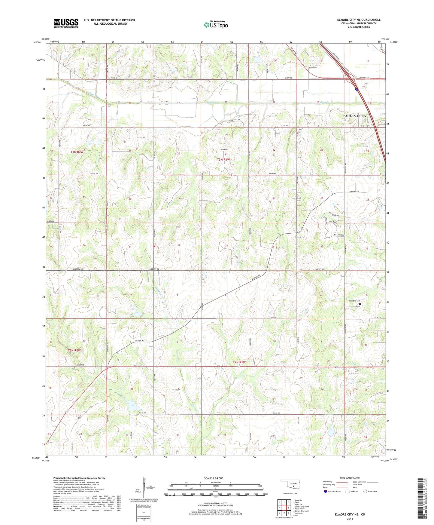
2022 topographic map quadrangle Elmore City NE in the state of Oklahoma. Scale: 1:24000. Based on the newly updated USGS 7.5' US Topo map series, this map is in the following counties: Garvin. The map contains contour data, water features, and other items you are used to seeing on USGS maps, but also has updated roads and other features. This is the next generation of topographic maps. Printed on high-quality waterproof paper with UV fade-resistant inks.
Quads adjacent to this one:
West: Elmore City North
Northwest: Maysville
North: Paoli
Northeast: Byars SW
East: Pauls Valley
Southeast: Joy
South: Hennepin
Southwest: Elmore City South
This map covers the same area as the classic USGS quad with code o34097f3.
Contains the following named places: Fair Oak Church, Garvin County, Klondike Cemetery, KVLH-AM (Pauls Valley), Love Church, McCarty, Oknoname 04912 Dam, Oknoname 04912 Reservoir, Oknoname 04922 Dam, Oknoname 04922 Reservoir, Rush Creek Fire Department, Rush Creek Site 37 and 39b Dam, Rush Creek Site 37 and 39b Reservoir, Rush Creek Site 39c Dam, Rush Creek Site 39c Reservoir, Shamley Gss Number 1 Dam, Shamley Gss Number 1 Reservoir, Temple Gss Number 1 Dam, Temple Gss Number 1 Reservoir, Valley Plaza Shopping Center, Wildhorse Creek Site 118 Dam, Wildhorse Creek Site 118 Reservoir, Wildhorse Creek Site 119 Dam, Wildhorse Creek Site 119 Reservoir, Wildhorse Creek Site 57 Dam, Wildhorse Creek Site 57 Reservoir