MyTopo
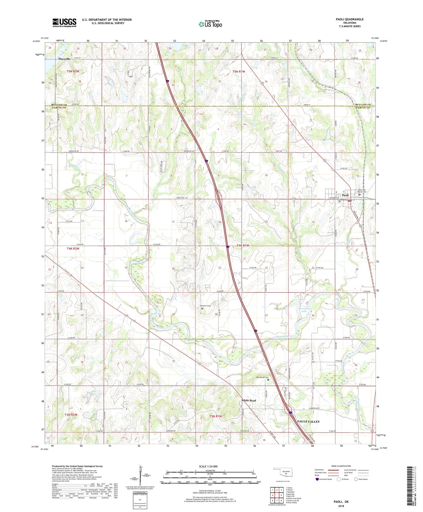
Paoli Oklahoma US Topo Map
Couldn't load pickup availability
2022 topographic map quadrangle Paoli in the state of Oklahoma. Scale: 1:24000. Based on the newly updated USGS 7.5' US Topo map series, this map is in the following counties: Garvin, McClain. The map contains contour data, water features, and other items you are used to seeing on USGS maps, but also has updated roads and other features. This is the next generation of topographic maps. Printed on high-quality waterproof paper with UV fade-resistant inks.
Quads adjacent to this one:
West: Maysville
Northwest: Stealy
North: Wayne
Northeast: Rosedale
East: Byars SW
Southeast: Pauls Valley
South: Elmore City NE
Southwest: Elmore City North
This map covers the same area as the classic USGS quad with code o34097g3.
Contains the following named places: Cheek Creek, Dulin and Walner Cemetery, Finn Creek Site 20 Dam, Finn Creek Site 20 Reservoir, Florence Cemetery, Gaddis Creek, Horseshoe Lake, Maysville Laterals Site L3 Dam, Maysville Laterals Site L3 Reservoir, Maysville Laterals Site L4 Dam, Maysville Laterals Site L4 Reservoir, Maysville Laterals Site L5 Dam, Maysville Laterals Site L5 Reservoir, Maysville Laterals Site L6 Dam, Maysville Laterals Site L6 Reservoir, Maysville Laterals Site L7 Dam, Maysville Laterals Site L7 Reservoir, Oknoname 04901 Dam, Oknoname 04901 Reservoir, Oknoname 04902 Dam, Oknoname 04902 Reservoir, Oknoname 04918 Dam, Oknoname 04918 Reservoir, Oknoname 087045 Dam, Oknoname 087045 Reservoir, Owl Creek, Owl Creek Site 5 Dam, Owl Creek Site 5 Reservoir, Owl Creek Site 6 Dam, Owl Creek Site 6 Reservoir, Owl Creek Site 7 Dam, Owl Creek Site 7 Reservoir, Paoli, Paoli Elementary School, Paoli Fire Department, Paoli High School, Paoli Police Department, Paoli Post Office, Pauls Valley Oil Field, Town of Paoli, Wayne Creek Site 1 Dam, Wayne Creek Site 1 Reservoir, Wayne Creek Site 2 Dam, Wayne Creek Site 2 Reservoir, West Owl Creek, West Pauls Valley Oil Field, Whitebead, Whitebead Cemetery, Whitebead Public Schools, Whitebead Township, ZIP Code: 73074