MyTopo
Burbank Oklahoma US Topo Map
Couldn't load pickup availability
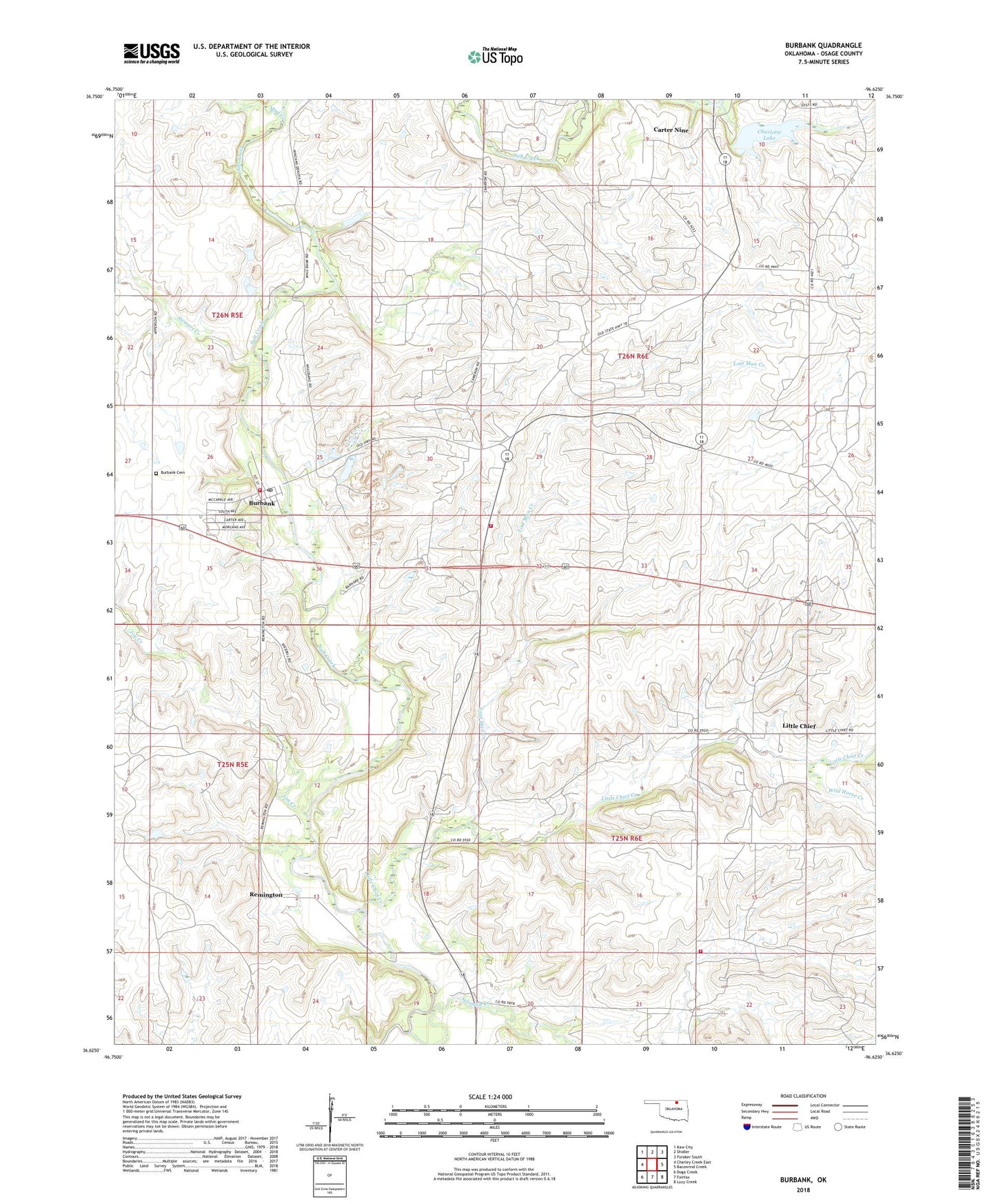
2022 topographic map quadrangle Burbank in the state of Oklahoma. Scale: 1:24000. Based on the newly updated USGS 7.5' US Topo map series, this map is in the following counties: Osage. The map contains contour data, water features, and other items you are used to seeing on USGS maps, but also has updated roads and other features. This is the next generation of topographic maps. Printed on high-quality waterproof paper with UV fade-resistant inks.
Quads adjacent to this one:
West: Charley Creek East
Northwest: Kaw City
North: Shidler
Northeast: Foraker South
East: Baconrind Creek
Southeast: Lucy Creek
South: Fairfax
Southwest: Doga Creek
This map covers the same area as the classic USGS quad with code o36096f6.
Contains the following named places: Burbank, Burbank Cemetery, Burbank Post Office, Burbank Volunteer Fire Department, Carter Nine, Charlotte Lake, Charlotte Lake Dam, Jim Creek, Lakeview Golf Course, Little Chief, Little Chief Creek, Little Chief Rural Fire Company Substation, Lost Man Creek, Lost Man Creek Rural Fire Company, Mud Creek, Phillips Lake, Remington, Rock Creek, Solomon Creek, Stewart Creek, Town of Burbank, Wild Horse Creek