MyTopo
Gene Autry Oklahoma US Topo Map
Couldn't load pickup availability
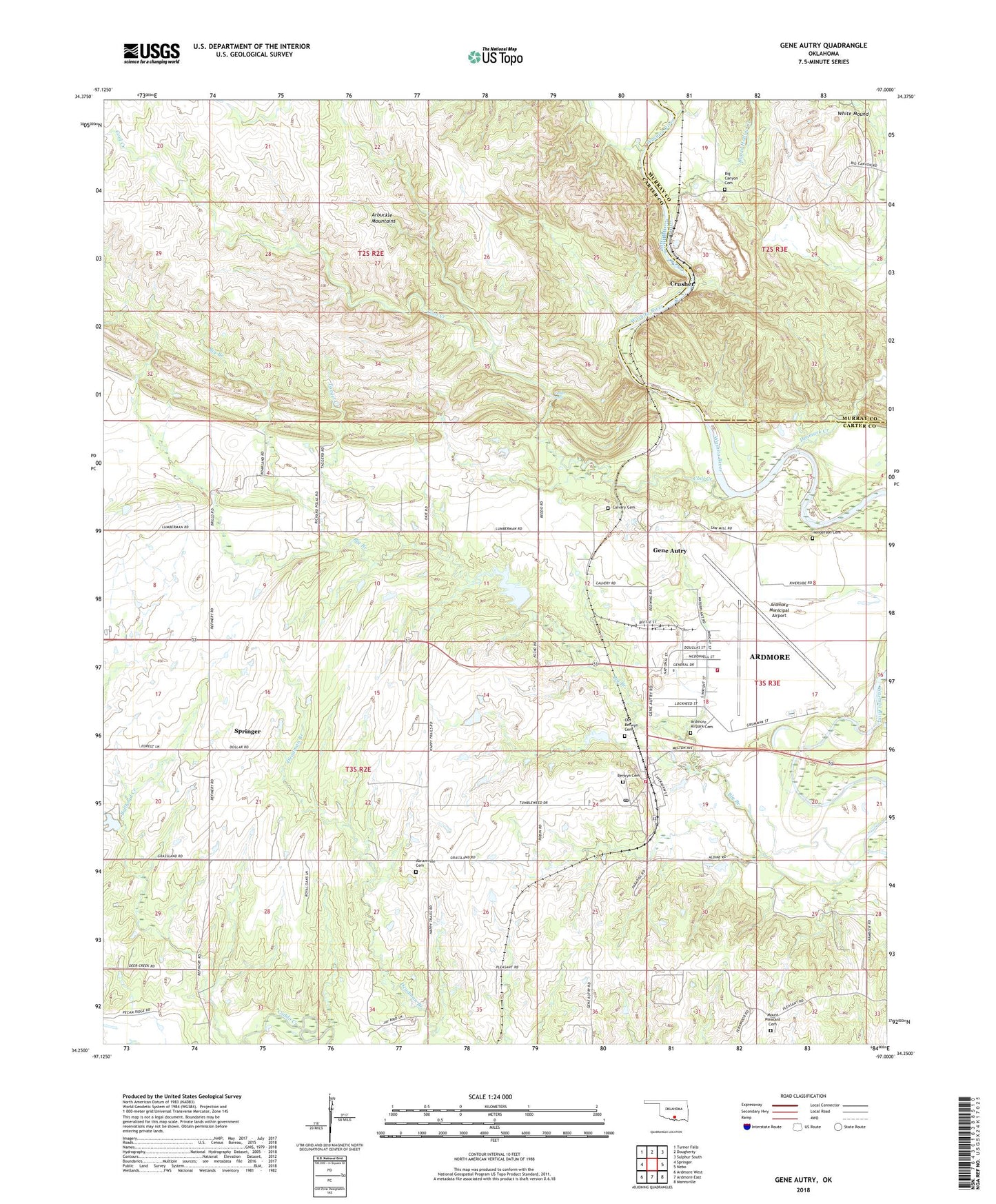
2018 topographic map quadrangle Gene Autry in the state of Oklahoma. Scale: 1:24000. Based on the newly updated USGS 7.5' US Topo map series, this map is in the following counties: Carter, Murray. The map contains contour data, water features, and other items you are used to seeing on USGS maps, but also has updated roads and other features. This is the next generation of topographic maps. Printed on high-quality waterproof paper with UV fade-resistant inks.
Quads adjacent to this one:
West: Springer
Northwest: Turner Falls
North: Dougherty
Northeast: Sulphur South
East: Nebo
Southeast: Mannsville
South: Ardmore East
Southwest: Ardmore West
Contains the following named places: Abramville Cemetery, Academy Church, Ardmore Air Force Base, Ardmore Air Park Fire Department Suite 7, Ardmore Army Air Field, Ardmore Industrial Airpark, Ardmore Municipal Airport, Berwyn Cemetery, Big Branch, Big Branch Cemetery, Big Canyon Cemetery, Board Hollow Creek, Bullhead Creek, Caddo Creek Site 28 Dam, Caddo Creek Site 28 Reservoir, Caddo Creek Site 29 Dam, Caddo Creek Site 29 Reservoir, Calvary Cemetery, Cedar Falls, Cool Creek, Crusher, Denmark Creek, Farmer Hole, Gene Autry, Gene Autry Fire Department, Gene Autry Post Office, Henderson Cemetery, Mount Pleasant Cemetery, Mount Pleasant Church, Old Berwyn Cemetery, Target Creek, Town of Gene Autry, Township of Berwyn, White Mound