MyTopo
Sulphur South Oklahoma US Topo Map
Couldn't load pickup availability
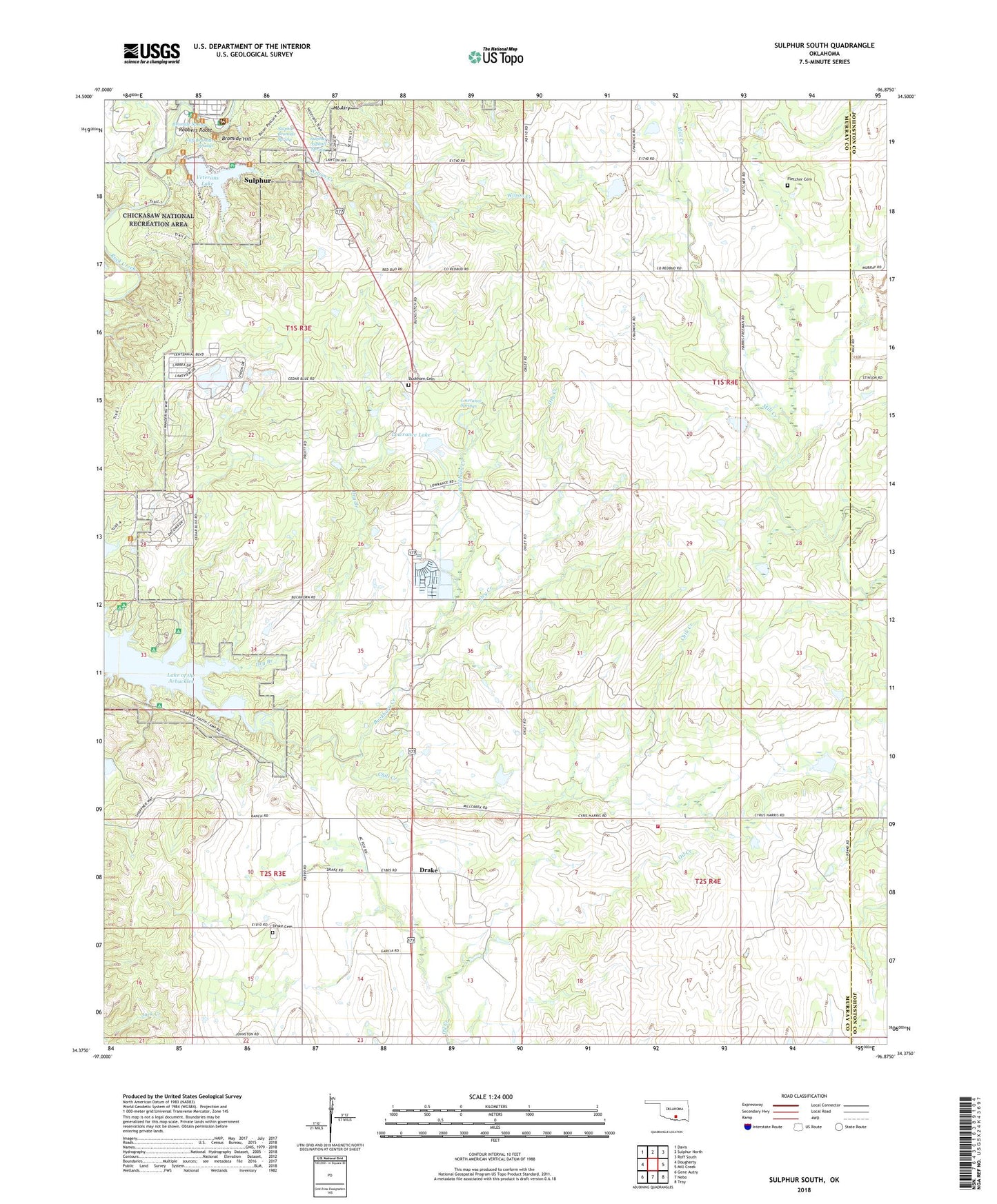
2022 topographic map quadrangle Sulphur South in the state of Oklahoma. Scale: 1:24000. Based on the newly updated USGS 7.5' US Topo map series, this map is in the following counties: Murray, Johnston. The map contains contour data, water features, and other items you are used to seeing on USGS maps, but also has updated roads and other features. This is the next generation of topographic maps. Printed on high-quality waterproof paper with UV fade-resistant inks.
Quads adjacent to this one:
West: Dougherty
Northwest: Davis
North: Sulphur North
Northeast: Roff South
East: Mill Creek
Southeast: Troy
South: Nebo
Southwest: Gene Autry
This map covers the same area as the classic USGS quad with code o34096d8.
Contains the following named places: Bromide Hill, Bromide Spring, Buckhorn Cemetery, Buckhorn Creek, Cedar Blue Volunteer Fire Department, Central Church, Chili Creek, Cliff Bromide Springs, Cliffside Trail, Drake, Drake - Nebo Cemetery, Dry Branch, Dry Creek, East Murray Division, Fletcher Cemetery, Lowrance Lake, Lowrance Springs, Mill Creek Watershed 10 Dam, Mill Creek Watershed 10 Reservoir, Mill Creek Watershed 14 Dam, Mill Creek Watershed 14 Reservoir, Mill Creek Watershed 16 Dam, Mill Creek Watershed 16 Reservoir, Mill Creek Watershed 8 Dam, Mill Creek Watershed 8 Reservoir, Mount Airy, Robbers Roost, Rock Prarie Fire Department, State Veterans Hospital, Sulphur Asphalt Spring, Sulphur Bromide Spring, Township of Lowrance, Township of Morgan, Veterans Lake, Veterans Lake Dam, Wilson Creek, ZIP Code: 73086