MyTopo
Glen Mountains Oklahoma US Topo Map
Couldn't load pickup availability
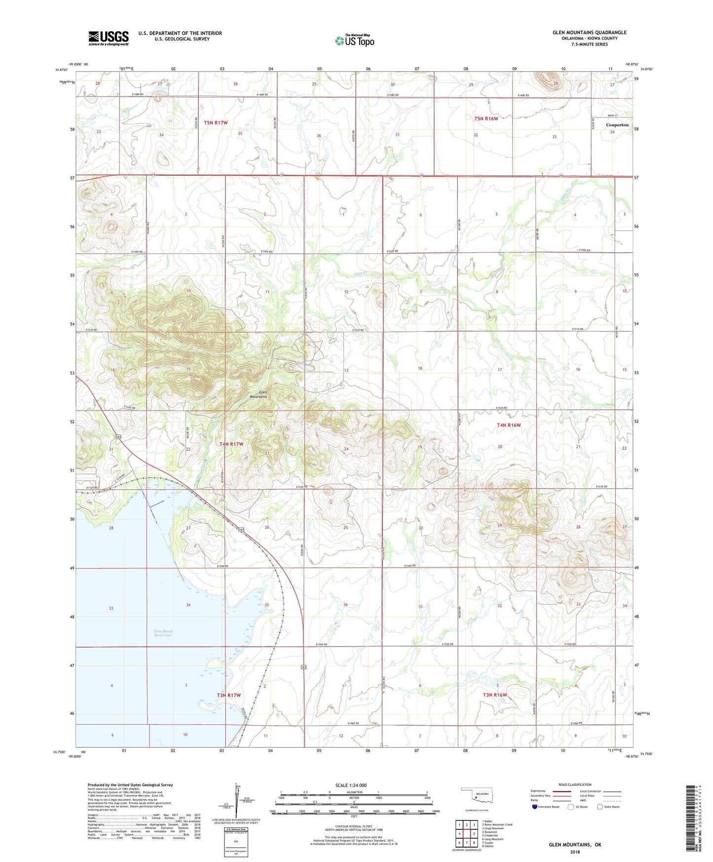
2018 topographic map quadrangle Glen Mountains in the state of Oklahoma. Scale: 1:24000. Based on the newly updated USGS 7.5' US Topo map series, this map is in the following counties: Kiowa. The map contains contour data, water features, and other items you are used to seeing on USGS maps, but also has updated roads and other features. This is the next generation of topographic maps. Printed on high-quality waterproof paper with UV fade-resistant inks.
Quads adjacent to this one:
West: Roosevelt
Northwest: Babbs
North: Rainy Mountain Creek
Northeast: Unap Mountain
East: Cooperton
Southeast: Odetta
South: Snyder
Southwest: Long Mountain
Contains the following named places: East Dike, Glen Creek, Glen Mountains, Great Plains State Park, Mountain Park Wildlife Area, Roosevelt Division, Tom Steed Reservoir, Town of Cooperton, ZIP Code: 73564