MyTopo
Rainy Mountain Creek Oklahoma US Topo Map
Couldn't load pickup availability
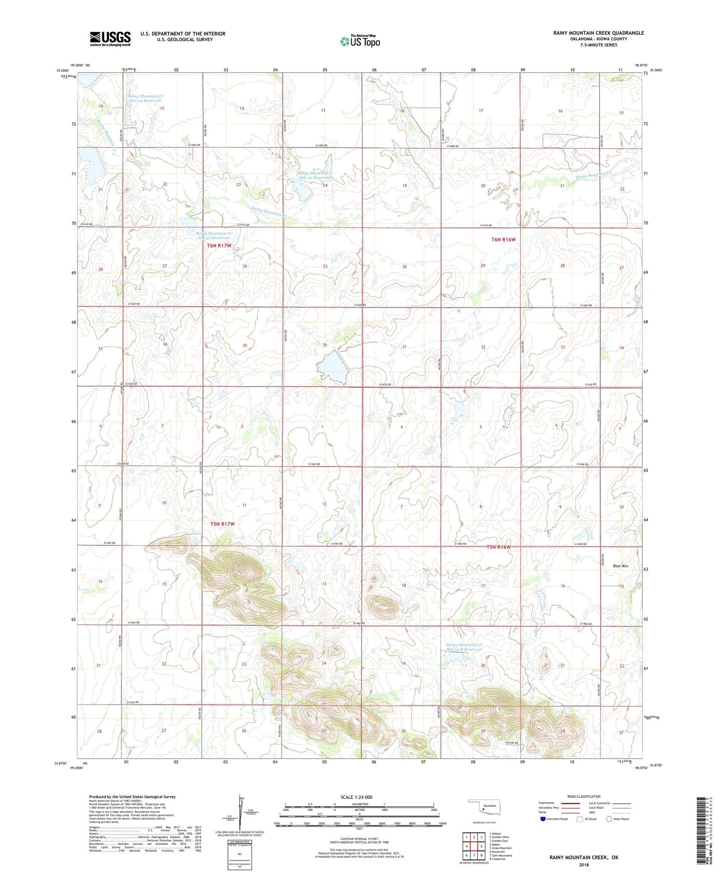
2022 topographic map quadrangle Rainy Mountain Creek in the state of Oklahoma. Scale: 1:24000. Based on the newly updated USGS 7.5' US Topo map series, this map is in the following counties: Kiowa. The map contains contour data, water features, and other items you are used to seeing on USGS maps, but also has updated roads and other features. This is the next generation of topographic maps. Printed on high-quality waterproof paper with UV fade-resistant inks.
Quads adjacent to this one:
West: Babbs
Northwest: Hobart
North: Gotebo West
Northeast: Gotebo East
East: Unap Mountain
Southeast: Cooperton
South: Glen Mountains
Southwest: Roosevelt
This map covers the same area as the classic USGS quad with code o34098h8.
Contains the following named places: Blue Mountain, Kiowa County, Rainy Mountain Church, Rainy Mountain Creek Site 15a Dam, Rainy Mountain Creek Site 15a Reservoir, Rainy Mountain Creek Site 15-B Dam, Rainy Mountain Creek Site 15-B Reservoir, Rainy Mountain Creek Site 16 Dam, Rainy Mountain Creek Site 16 Reservoir, Rainy Mountain Creek Site 17 Dam, Rainy Mountain Creek Site 17 Reservoir, Rainy Mountain Creek Site 19 Dam, Rainy Mountain Creek Site 19 Reservoir, Rainy Mountain Creek Site 21 Dam, Rainy Mountain Creek Site 21 Reservoir, Rainy Mountain Creek Site 22 Dam, Rainy Mountain Creek Site 22 Reservoir, Rainy Mountain Creek Site 23 Dam, Rainy Mountain Creek Site 23 Reservoir, Rainy Mountain Creek Site 24 Dam, Rainy Mountain Creek Site 24 Reservoir, Rainy Mountain Creek Site 25 Dam, Rainy Mountain Creek Site 25 Reservoir, Township of Cooper