MyTopo
Roosevelt Oklahoma US Topo Map
Couldn't load pickup availability
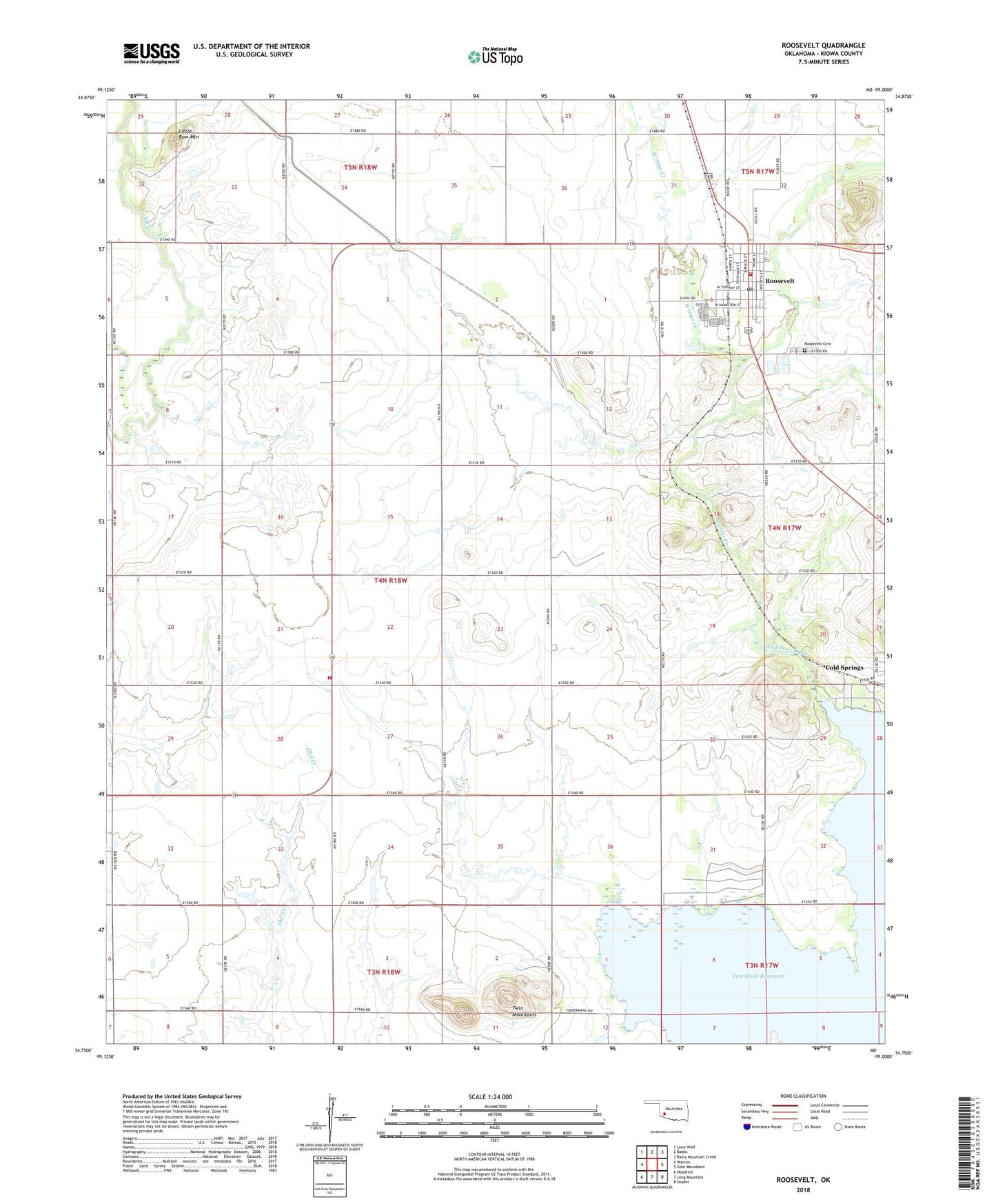
2022 topographic map quadrangle Roosevelt in the state of Oklahoma. Scale: 1:24000. Based on the newly updated USGS 7.5' US Topo map series, this map is in the following counties: Kiowa. The map contains contour data, water features, and other items you are used to seeing on USGS maps, but also has updated roads and other features. This is the next generation of topographic maps. Printed on high-quality waterproof paper with UV fade-resistant inks.
Quads adjacent to this one:
West: Warren
Northwest: Lone Wolf
North: Babbs
Northeast: Rainy Mountain Creek
East: Glen Mountains
Southeast: Snyder
South: Long Mountain
Southwest: Headrick
This map covers the same area as the classic USGS quad with code o34099g1.
Contains the following named places: Cold Springs, Consolidated - 8 Volunteer Fire Department, Little Bow Mountain, Oknoname 075003 Dam, Oknoname 075003 Reservoir, Oknoname 075004 Dam, Oknoname 375004 Reservoir, Roosevelt, Roosevelt Cemetery, Roosevelt Post Office, Roosevelt Volunteer Fire Department, Town of Roosevelt, Township of Otter Creek, Twin Mountains, West Dike