MyTopo
Babbs Oklahoma US Topo Map
Couldn't load pickup availability
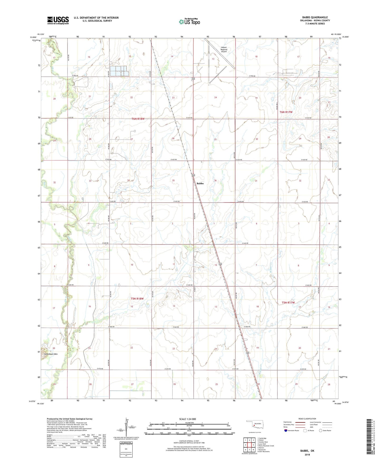
2022 topographic map quadrangle Babbs in the state of Oklahoma. Scale: 1:24000. Based on the newly updated USGS 7.5' US Topo map series, this map is in the following counties: Kiowa. The map contains contour data, water features, and other items you are used to seeing on USGS maps, but also has updated roads and other features. This is the next generation of topographic maps. Printed on high-quality waterproof paper with UV fade-resistant inks.
Quads adjacent to this one:
West: Lone Wolf
Northwest: Cambridge
North: Hobart
Northeast: Gotebo West
East: Rainy Mountain Creek
Southeast: Glen Mountains
South: Roosevelt
Southwest: Warren
This map covers the same area as the classic USGS quad with code o34099h1.
Contains the following named places: Babbs, Hobart Army Air Field, Hobart Country Club, Hobart Regional Airport, Oknoname 075011 Dam, Oknoname 375011 Reservoir