MyTopo
Grainola Oklahoma US Topo Map
Couldn't load pickup availability
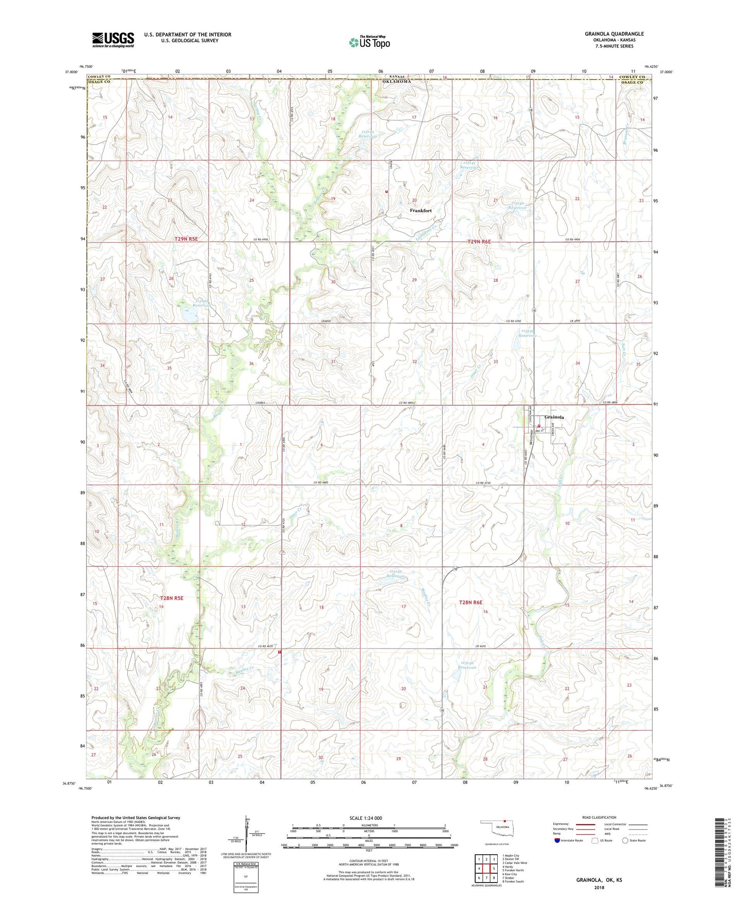
2018 topographic map quadrangle Grainola in the state of Oklahoma. Scale: 1:24000. Based on the newly updated USGS 7.5' US Topo map series, this map is in the following counties: Osage, Cowley, Kay. The map contains contour data, water features, and other items you are used to seeing on USGS maps, but also has updated roads and other features. This is the next generation of topographic maps. Printed on high-quality waterproof paper with UV fade-resistant inks.
Quads adjacent to this one:
West: Hardy
Northwest: Maple City
North: Dexter SW
Northeast: Cedar Vale West
East: Foraker North
Southeast: Foraker South
South: Shidler
Southwest: Kaw City
Contains the following named places: Antelope Creek, Bayliss Creek, Big Beaver Fire Department, Frankfort, Frankfort Oil Field, Frankfort Rural Fire Company, Grainola, Grainola Volunteer Fire Department, Lone Tree Creek, Oknoname 113139 Dam, Oknoname 113139 Reservoir, Oknoname 113140 Dam, Oknoname 113140 Reservoir, Oknoname 113141 Dam, Oknoname 113141 Reservoir, Oknoname 113142 Dam, Oknoname 113142 Reservoir, Oknoname 113143 Dam, Oknoname 113143 Reservoir, Oknoname 113144 Dam, Oknoname 113144 Reservoir, Oknoname 113145 Dam, Oknoname 113145 Reservoir, Oknoname 113146 Dam, Oknoname 113146 Reservoir, Otter Creek, Spring Creek, Town of Grainola