MyTopo
Headrick Oklahoma US Topo Map
Couldn't load pickup availability
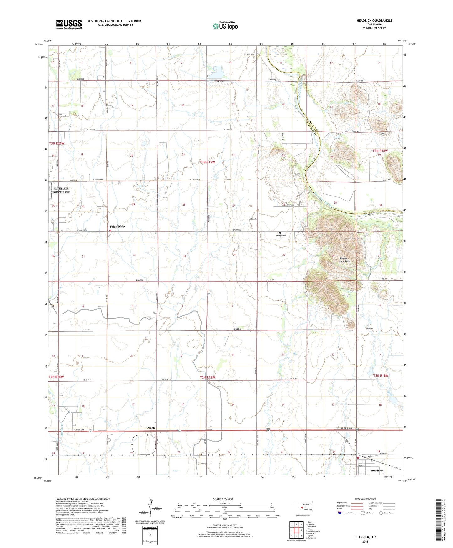
2018 topographic map quadrangle Headrick in the state of Oklahoma. Scale: 1:24000. Based on the newly updated USGS 7.5' US Topo map series, this map is in the following counties: Jackson, Kiowa. The map contains contour data, water features, and other items you are used to seeing on USGS maps, but also has updated roads and other features. This is the next generation of topographic maps. Printed on high-quality waterproof paper with UV fade-resistant inks.
Quads adjacent to this one:
West: Altus
Northwest: Blair
North: Warren
Northeast: Roosevelt
East: Long Mountain
Southeast: Tipton SE
South: Tipton
Southwest: Altus SE
Contains the following named places: East Jackson Division, Friendship, Friendship Church, Friendship Volunteer Fire Department Station 1, Headrick, Headrick Post Office, Headrick Volunteer Fire Department, Navajo Cemetery, Navajo Elementary School, Navajo High School, Navajo Junior High School, Navajo Mountains, Oknoname 065002 Dam, Oknoname 065002 Reservoir, Ozark, Ozark Canal, Town of Friendship, Town of Headrick, ZIP Code: 73549