MyTopo
Hitchcock Oklahoma US Topo Map
Couldn't load pickup availability
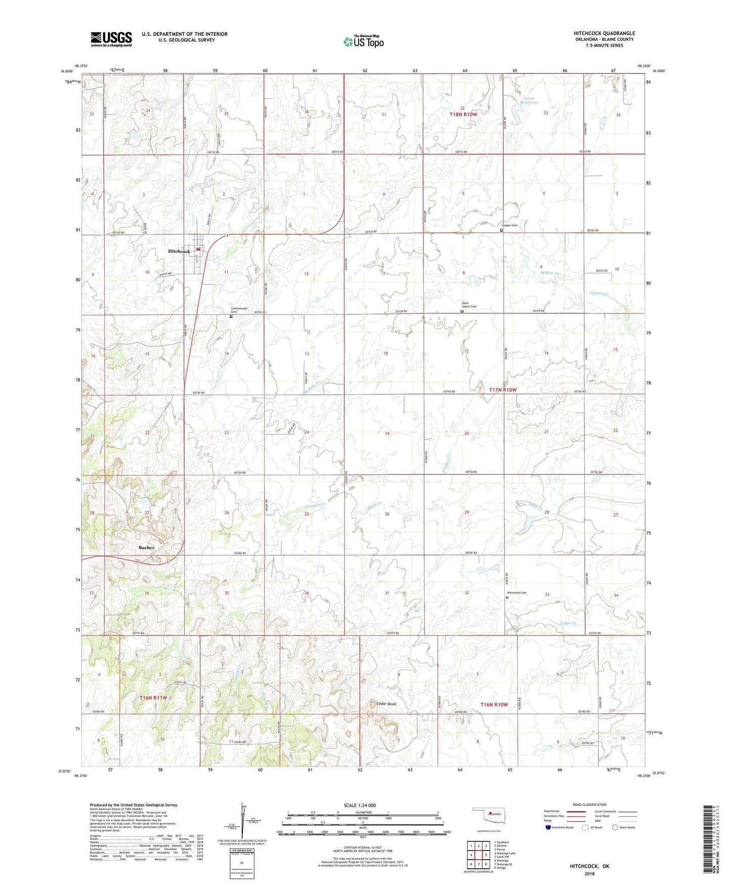
2022 topographic map quadrangle Hitchcock in the state of Oklahoma. Scale: 1:24000. Based on the newly updated USGS 7.5' US Topo map series, this map is in the following counties: Blaine. The map contains contour data, water features, and other items you are used to seeing on USGS maps, but also has updated roads and other features. This is the next generation of topographic maps. Printed on high-quality waterproof paper with UV fade-resistant inks.
Quads adjacent to this one:
West: Watonga Lake
Northwest: Southard
North: Okeene
Northeast: Parvin
East: Loyal NW
Southeast: Omega
South: Watonga SE
Southwest: Watonga
This map covers the same area as the classic USGS quad with code o35098h3.
Contains the following named places: Bucher, Cedar Knoll, Cooper Cemetery, Cottonwood Cemetery, Hitchcock, Hitchcock Fire Department, Hitchcock Post Office, Hitchcock United Methodist Church, Oknoname 01101 Dam, Oknoname 01101 Reservoir, Saint John's Cemetery, Tonkawa Creek Site 101 Dam, Tonkawa Creek Site 101 Reservoir, Town of Hitchcock, Township of Lawton, Township of Wells, Watonga Emergency Medical Services Hitchcock, Willow Creek, Winnview Cemetery, ZIP Code: 73744