MyTopo
Watonga Lake Oklahoma US Topo Map
Couldn't load pickup availability
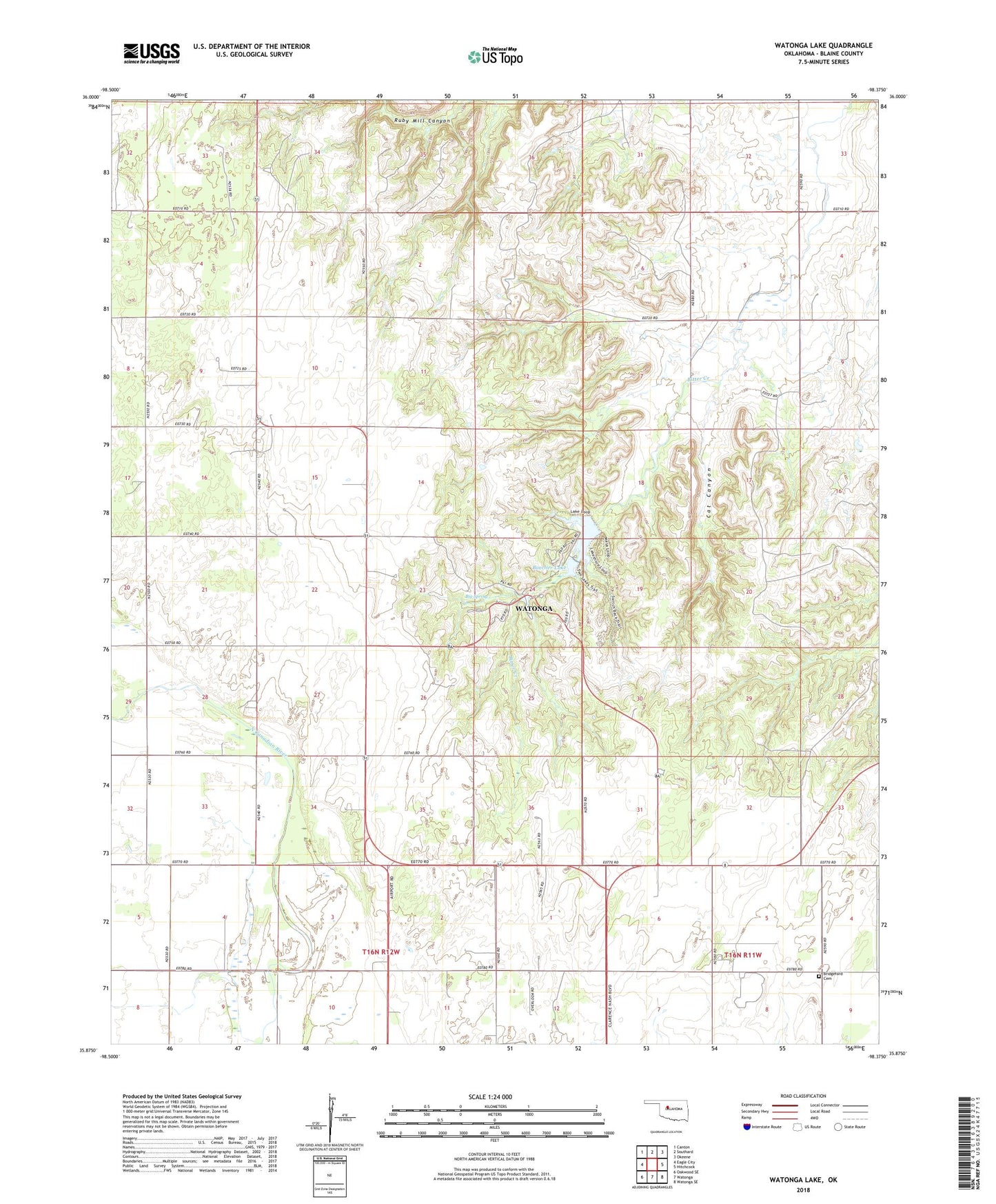
2022 topographic map quadrangle Watonga Lake in the state of Oklahoma. Scale: 1:24000. Based on the newly updated USGS 7.5' US Topo map series, this map is in the following counties: Blaine. The map contains contour data, water features, and other items you are used to seeing on USGS maps, but also has updated roads and other features. This is the next generation of topographic maps. Printed on high-quality waterproof paper with UV fade-resistant inks.
Quads adjacent to this one:
West: Eagle City
Northwest: Canton
North: Southard
Northeast: Okeene
East: Hitchcock
Southeast: Watonga SE
South: Watonga
Southwest: Oakwood SE
This map covers the same area as the classic USGS quad with code o35098h4.
Contains the following named places: Big Spring, Blaine County, Boecher Lake, Boecher Lake Dam, Bridgeford Cemetery, Cat Canyon, KIMY-FM (Watonga), Roman Nose State Park, Township of River, Watonga Lake, Watonga Lake Dam