MyTopo
Watonga Oklahoma US Topo Map
Couldn't load pickup availability
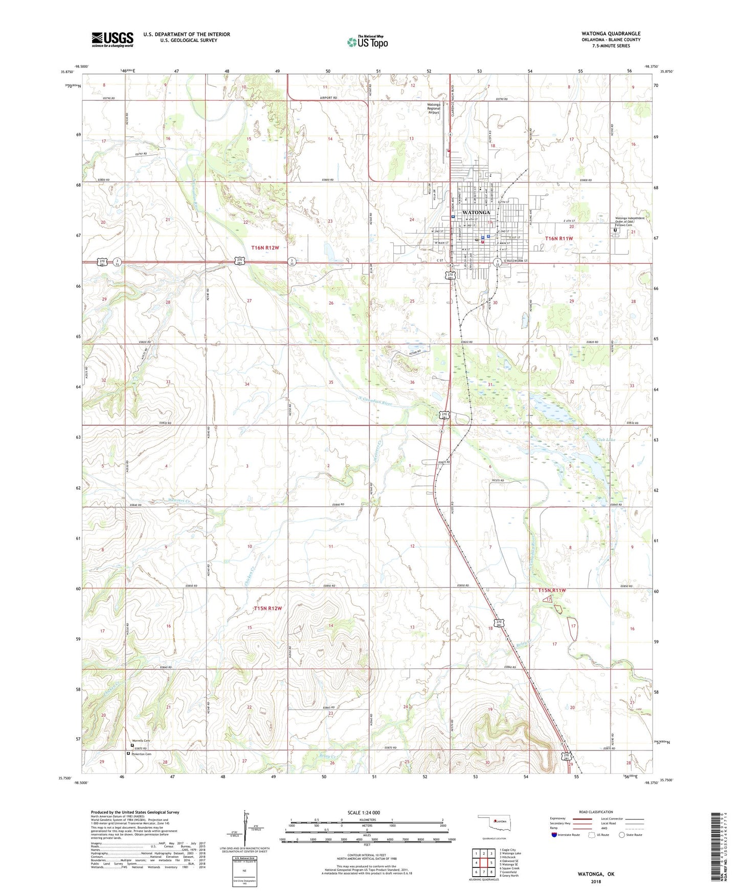
2022 topographic map quadrangle Watonga in the state of Oklahoma. Scale: 1:24000. Based on the newly updated USGS 7.5' US Topo map series, this map is in the following counties: Blaine. The map contains contour data, water features, and other items you are used to seeing on USGS maps, but also has updated roads and other features. This is the next generation of topographic maps. Printed on high-quality waterproof paper with UV fade-resistant inks.
Quads adjacent to this one:
West: Oakwood SE
Northwest: Eagle City
North: Watonga Lake
Northeast: Hitchcock
East: Watonga SE
Southeast: Geary North
South: Greenfield
Southwest: Squaw Creek
This map covers the same area as the classic USGS quad with code o35098g4.
Contains the following named places: Blaine County Jail, Blaine County Sheriff's Office, Catholic Church, Chicken Creek, Christ Gospel Church, Christian Church, Church of Christ, Church of God in Christ, City of Watonga, Club Lake, First Assembly of God Church, First Baptist Church, Greenfield Police Department, Industrial School, Mercy Hospital Watonga, Mount Calvary Lutheran Church, Pentecostal Church of God, Pinkerton Cemetery, Relay Creek, Township of Dixon, Township of Watonga, Trinity Baptist Church, Union Baptist Church, United Meethodist Church, USPHS Watonga Health Center, Watonga, Watonga Division, Watonga Elementary School, Watonga Fire Department, Watonga Fire Department Substation, Watonga High School, Watonga Independent Order of Odd Fellows Cemetery, Watonga Indian Cemetery, Watonga Middle School, Watonga Police Department, Watonga Post Office, Watonga Regional Airport, Weavers Creek, Worrells Cemetery, ZIP Code: 73772