MyTopo
Hobart Oklahoma US Topo Map
Couldn't load pickup availability
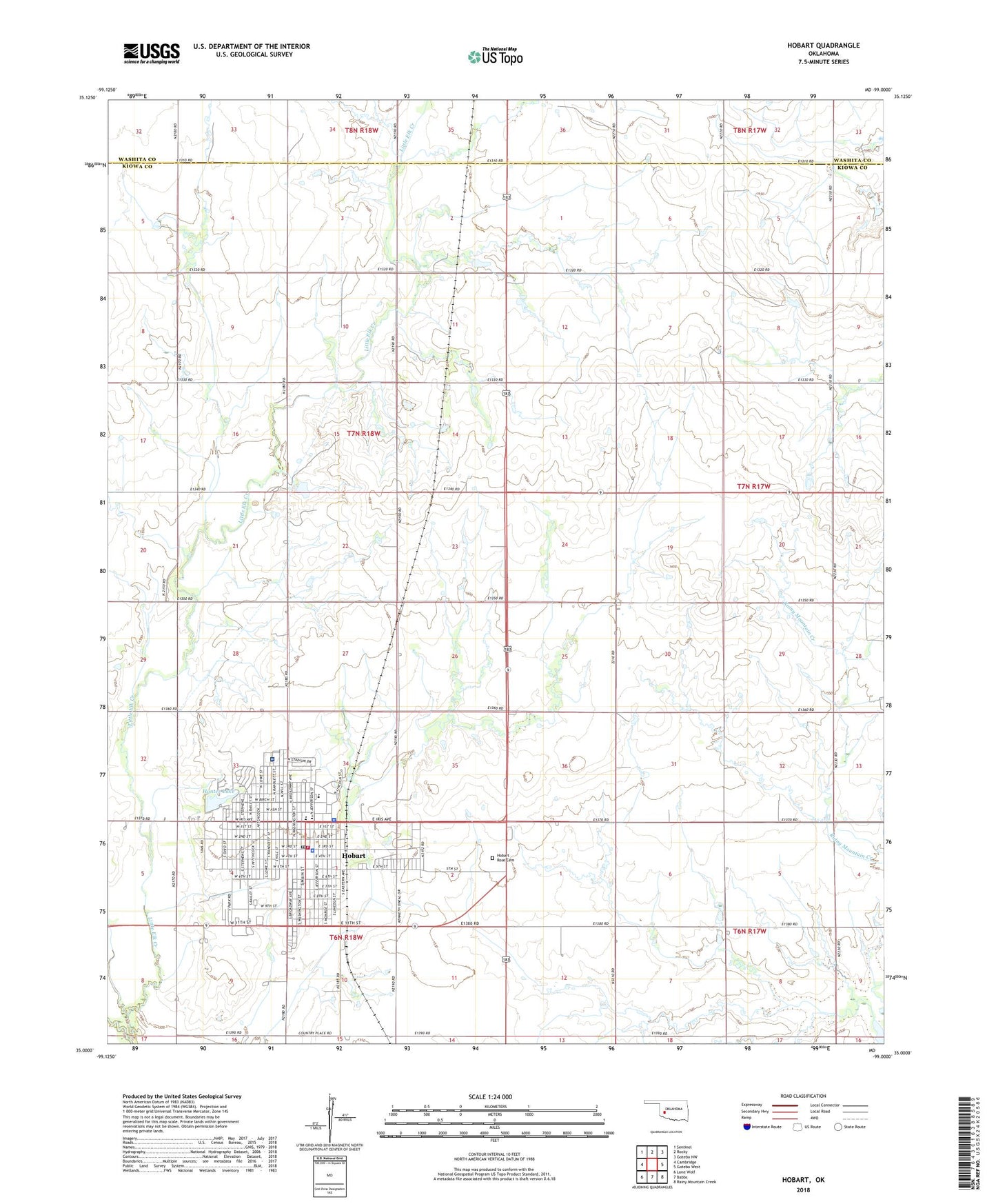
2018 topographic map quadrangle Hobart in the state of Oklahoma. Scale: 1:24000. Based on the newly updated USGS 7.5' US Topo map series, this map is in the following counties: Kiowa, Washita. The map contains contour data, water features, and other items you are used to seeing on USGS maps, but also has updated roads and other features. This is the next generation of topographic maps. Printed on high-quality waterproof paper with UV fade-resistant inks.
Quads adjacent to this one:
West: Cambridge
Northwest: Sentinel
North: Rocky
Northeast: Gotebo NW
East: Gotebo West
Southeast: Rainy Mountain Creek
South: Babbs
Southwest: Lone Wolf
Contains the following named places: Biggers Park, Brico, Church of Christ, City of Hobart, Elkview General Hospital, Emerson School, Field School, First Baptist Church, First Christian Church, First Lutheran Church, First United Methodist Church, Hobart, Hobart Division, Hobart Elementary School, Hobart Fire Department, Hobart High School, Hobart Middle School, Hobart Police Department, Hobart Post Office, Hobart Rose Cemetery, Hunter Dam, Hunter Lake, Hunter Park, Kiowa County Jail, Kiowa County Sheriff's Office, KTJS-AM (Hobart), Little Elk Creek, Pentecostal Church of God, Pentecostal Temple, Sinor Emergency Medical Service, Spanish Baptist Mission, Township of Hobart, Village Mall, Willard School, ZIP Code: 73651