MyTopo
Inola Oklahoma US Topo Map
Couldn't load pickup availability
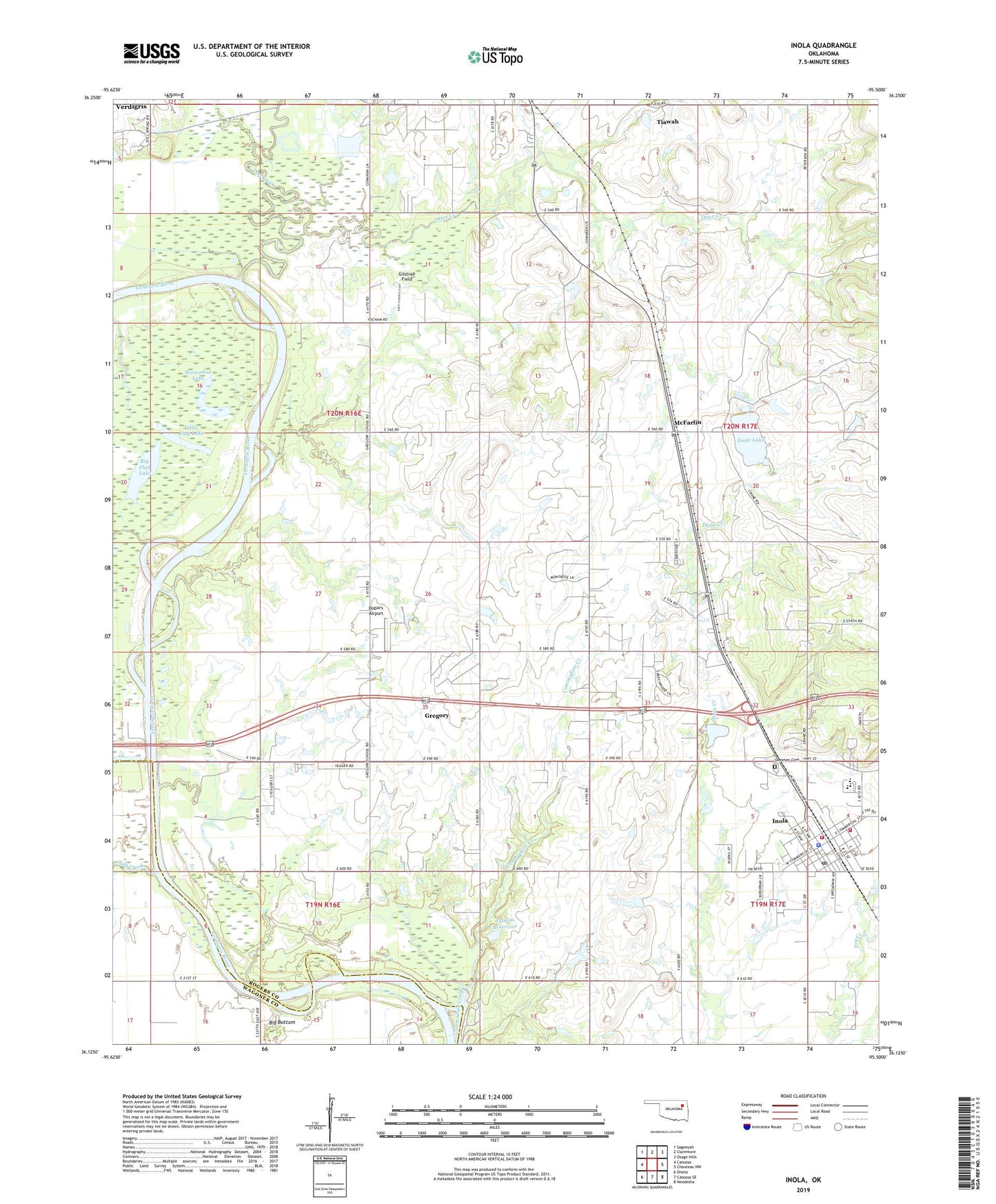
2019 topographic map quadrangle Inola in the state of Oklahoma. Scale: 1:24000. Based on the newly updated USGS 7.5' US Topo map series, this map is in the following counties: Rogers, Wagoner. The map contains contour data, water features, and other items you are used to seeing on USGS maps, but also has updated roads and other features. This is the next generation of topographic maps. Printed on high-quality waterproof paper with UV fade-resistant inks.
Quads adjacent to this one:
West: Catoosa
Northwest: Sageeyah
North: Claremore
Northeast: Osage Hills
East: Chouteau NW
Southeast: Neodesha
South: Catoosa SE
Southwest: Oneta
Contains the following named places: Big Flag Lake, Commodore Creek, Dobie's Airport, Dog Creek, Gilstrap Field, Gregory, Gregory Census Designated Place, Gregory Church, Gregory School, Horseshoe Lake, Inola, Inola Division, Inola Elementary School, Inola Fire Department Station 1 Headquarters, Inola Fire Department Station 2, Inola High School, Inola Lake, Inola Lake Dam, Inola Middle School, Inola Police Department, Inola Post Office, Little Flag Lake, McFarlin, Night Hawk Airpatch, Oknoname 131006 Dam, Oknoname 131006 Reservoir, Otter Creek, Rocky Point Public Use Area, Salt Creek, Sweeten Cemetery, Tiawah, Tiawah Census Designated Place, Township of Inola, Willieo Church, ZIP Code: 74036