MyTopo
Oktaha Oklahoma US Topo Map
Couldn't load pickup availability
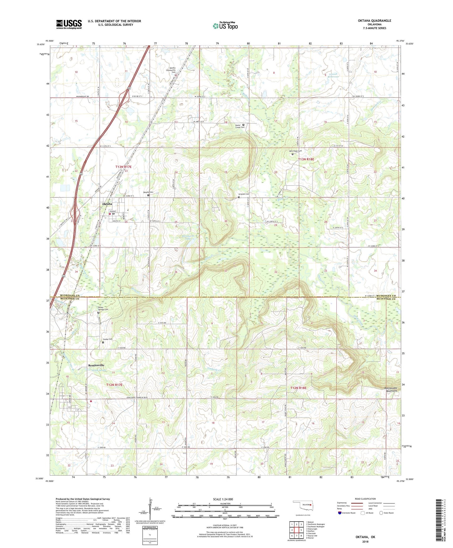
2022 topographic map quadrangle Oktaha in the state of Oklahoma. Scale: 1:24000. Based on the newly updated USGS 7.5' US Topo map series, this map is in the following counties: Muskogee, McIntosh. The map contains contour data, water features, and other items you are used to seeing on USGS maps, but also has updated roads and other features. This is the next generation of topographic maps. Printed on high-quality waterproof paper with UV fade-resistant inks.
Quads adjacent to this one:
West: Wainwright
Northwest: Beland
North: Southwest Muskogee
Northeast: Southeast Muskogee
East: Keefton
Southeast: Warner
South: Warner NW
Southwest: Checotah
This map covers the same area as the classic USGS quad with code o35095e4.
Contains the following named places: Anderson Creek, Butler Creek, Butler Creek Cemetery, Butler Creek Indian Baptist Church, Combs Cemetery, Elk Creek, Grayson Cemetery, Honey Springs, Honey Springs Branch, Honey Springs Cemetery, Liberty Church, May Evergreen Church, Mount Zion Church, Muskogee County, New Hope Cemetery, New Hope Church, Oknoname 101006 Dam, Oknoname 101006 Reservoir, Oknoname 101007 Dam, Oknoname 101007 Reservoir, Oktaha, Oktaha Cemetery, Oktaha Community Cemetery, Oktaha High School, Oktaha Post Office, Oktaha School, Oktaha Volunteer Fire Department, Rattlesnake Mountains, Reinhardt Lake, Rentiesville, Rentiesville Area Rural Fire Department, Timberly Creek, Town of Oktaha, Town of Rentiesville, Township of Beck, Township of Darling, Wayside Creek, ZIP Codes: 74450, 74459