MyTopo
Kiamichi Oklahoma US Topo Map
Couldn't load pickup availability
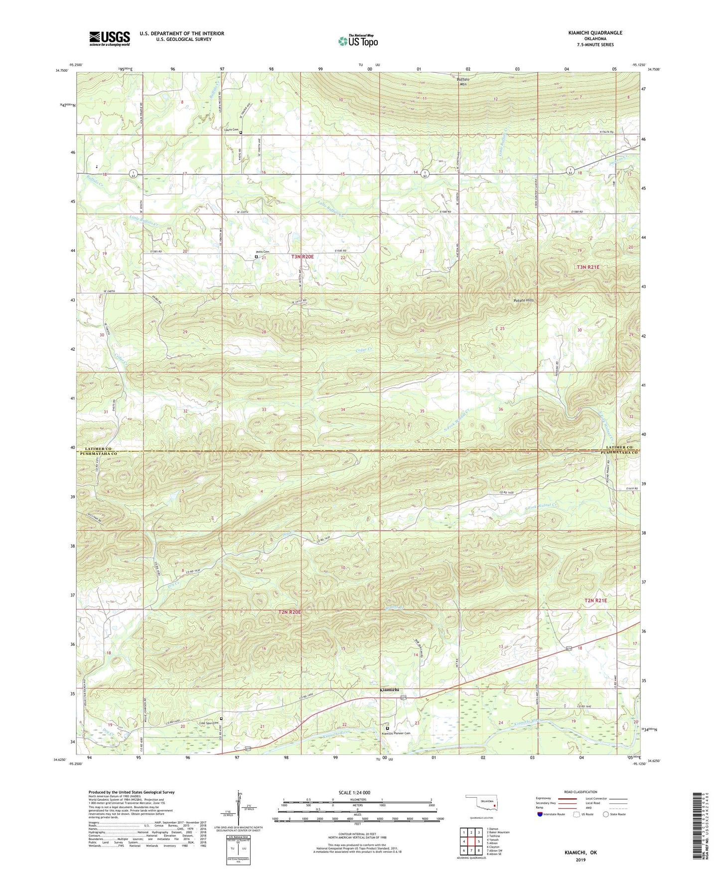
2022 topographic map quadrangle Kiamichi in the state of Oklahoma. Scale: 1:24000. Based on the newly updated USGS 7.5' US Topo map series, this map is in the following counties: Pushmataha, Latimer. The map contains contour data, water features, and other items you are used to seeing on USGS maps, but also has updated roads and other features. This is the next generation of topographic maps. Printed on high-quality waterproof paper with UV fade-resistant inks.
Quads adjacent to this one:
West: Yanush
Northwest: Damon
North: Baker Mountain
Northeast: Talihina
East: Albion
Southeast: Albion SE
South: Albion SW
Southwest: Clayton
This map covers the same area as the classic USGS quad with code o34095f2.
Contains the following named places: Bryant Branch, Buffalo Valley Elementary School, Buffalo Valley High School, Cole Spur Cemetery, Falfa Church, Friendship Church, Hatton Ranch Airport, Kiamichi, Kiamichi Pioneer Cemetery, Laura Cemetery, Little Buffalo Creek, North Fork Walnut Creek, Oknoname 077007 Dam, Oknoname 077007 Reservoir, Potato Hills, Potts Cemetery, South Fork Walnut Creek