MyTopo
Clayton Oklahoma US Topo Map
Couldn't load pickup availability
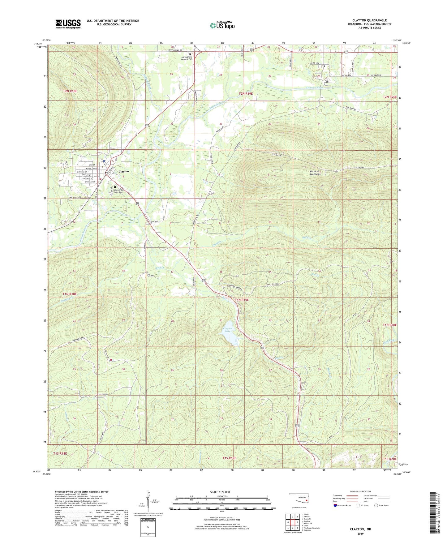
2022 topographic map quadrangle Clayton in the state of Oklahoma. Scale: 1:24000. Based on the newly updated USGS 7.5' US Topo map series, this map is in the following counties: Pushmataha. The map contains contour data, water features, and other items you are used to seeing on USGS maps, but also has updated roads and other features. This is the next generation of topographic maps. Printed on high-quality waterproof paper with UV fade-resistant inks.
Quads adjacent to this one:
West: Stanley
Northwest: Sardis
North: Yanush
Northeast: Kiamichi
East: Albion SW
Southeast: Nashoba
South: Wildhorse Mountain
Southwest: Snow
This map covers the same area as the classic USGS quad with code o34095e3.
Contains the following named places: A L Stephens Memorial Park, Alexander Trail, Buffalo Valley Volunteer Fire Department, Clayton, Clayton Dam, Clayton Fire Department, Clayton High School, Clayton Lake, Clayton Lake State Recreation Area, Clayton Old Town Cemetery, Clayton Police Department, Clayton Post Office, Clayton Trail, Crain Elementary School, Hurd Creek, Hurd Creek Trail, Jackfork Creek, Minnetonka Camp, North Pushmataha Division, Oklahoma Department of Wildlife Conservation Pushmataha County State Game Refuge, Peal Creek, Peterson Creek, Town of Clayton, Township of Tuskahoma, Tuskahoma, Tuskahoma Elementary School, Tuskahoma Post Office, Walters Mule Trail