MyTopo
Albion SW Oklahoma US Topo Map
Couldn't load pickup availability
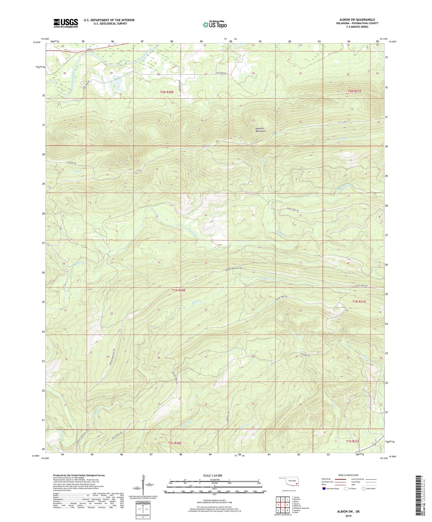
2022 topographic map quadrangle Albion SW in the state of Oklahoma. Scale: 1:24000. Based on the newly updated USGS 7.5' US Topo map series, this map is in the following counties: Pushmataha. The map contains contour data, water features, and other items you are used to seeing on USGS maps, but also has updated roads and other features. This is the next generation of topographic maps. Printed on high-quality waterproof paper with UV fade-resistant inks.
Quads adjacent to this one:
West: Clayton
Northwest: Yanush
North: Kiamichi
Northeast: Albion
East: Albion SE
Southeast: Clebit
South: Nashoba
Southwest: Wildhorse Mountain
This map covers the same area as the classic USGS quad with code o34095e2.
Contains the following named places: Black Fork Trail, Cripple Mountain Trail, Dry Creek, Garland Trail, Kiamichi Fish Farm, Long Creek, ZIP Code: 74558