MyTopo
Kildare Oklahoma US Topo Map
Couldn't load pickup availability
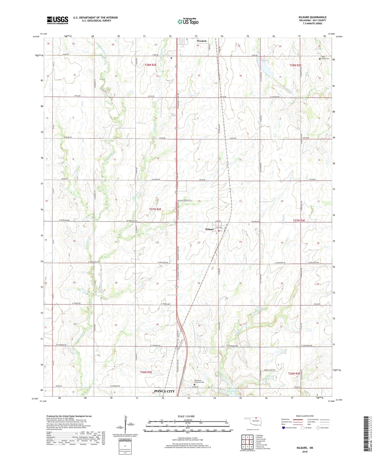
2022 topographic map quadrangle Kildare in the state of Oklahoma. Scale: 1:24000. Based on the newly updated USGS 7.5' US Topo map series, this map is in the following counties: Kay. The map contains contour data, water features, and other items you are used to seeing on USGS maps, but also has updated roads and other features. This is the next generation of topographic maps. Printed on high-quality waterproof paper with UV fade-resistant inks.
Quads adjacent to this one:
West: Newkirk SW
Northwest: Peckham
North: Newkirk
Northeast: Kaw City NW
East: Uncas
Southeast: Charley Creek West
South: Ponca City
Southwest: Ponca City NW
This map covers the same area as the classic USGS quad with code o36097g1.
Contains the following named places: Eagles Landing, First Free Will Baptist Church, Grass Roots Airport, Kay County Sheriff's Office, Kildare, Kildare Elementary School, Kildare Volunteer Fire Department, KIXR-FM (Ponca City), KLOR-FM (Ponca City), Newkirk Country Club, Newkirk Country Club Dam, Newkirk Country Club Lake, Newkirk Middle School, Northwest Kildare Oil and Gas Field, Oknoname 071024 Dam, Oknoname 071024 Reservoir, Oknoname 071026 Dam, Oknoname 071026 Reservoir, Oknoname 071027 Dam, Oknoname 071027 Reservoir, Pleasant View Church, Pleasant View School, Resthaven Memorial Park, Sky Park, Spring Creek, Town of Kildare, Township of Kildare, Turkey Creek, Wolf Creek Cemetery