MyTopo
Newkirk Oklahoma US Topo Map
Couldn't load pickup availability
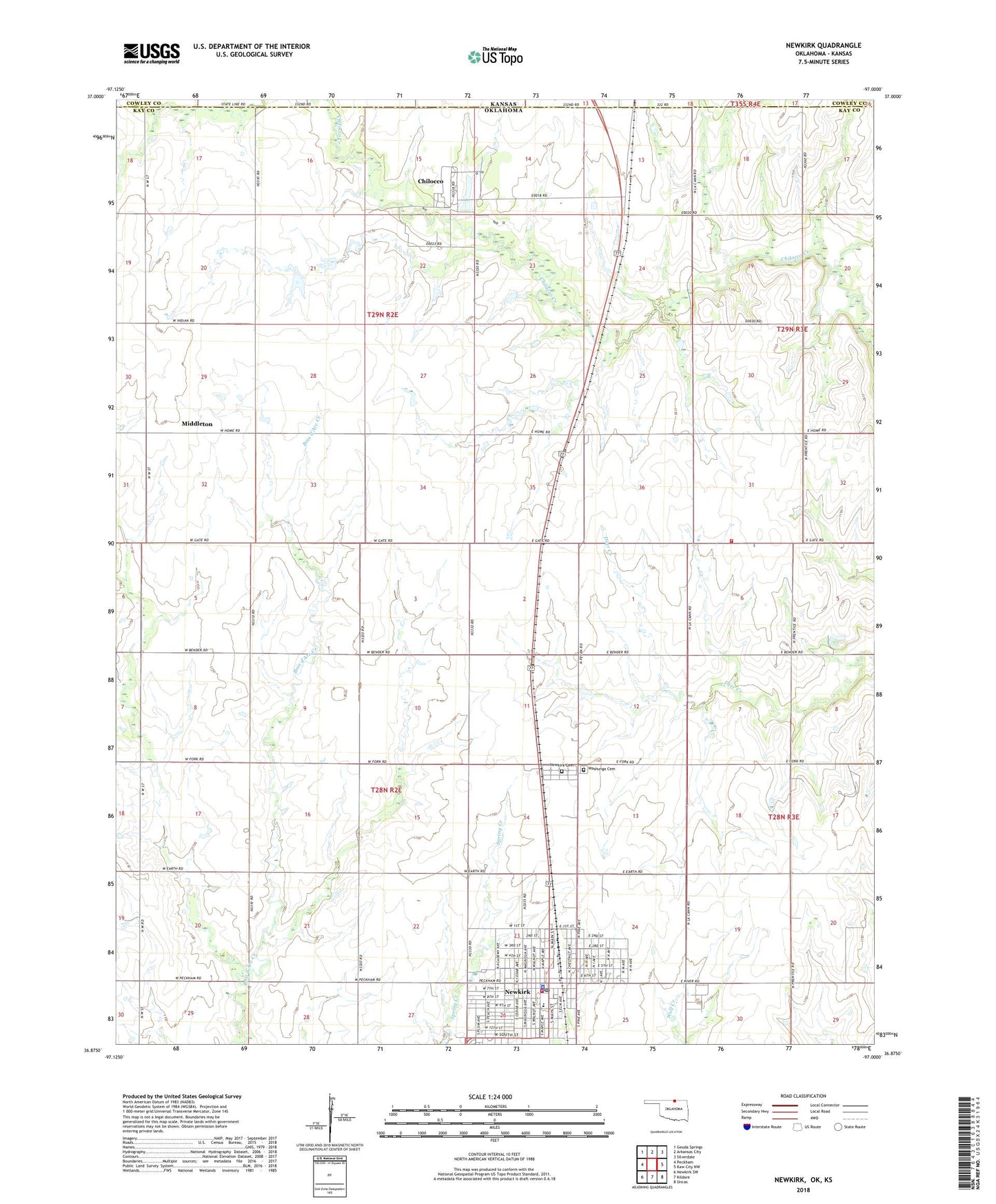
2022 topographic map quadrangle Newkirk in the state of Oklahoma. Scale: 1:24000. Based on the newly updated USGS 7.5' US Topo map series, this map is in the following counties: Kay, Cowley. The map contains contour data, water features, and other items you are used to seeing on USGS maps, but also has updated roads and other features. This is the next generation of topographic maps. Printed on high-quality waterproof paper with UV fade-resistant inks.
Quads adjacent to this one:
West: Peckham
Northwest: Geuda Springs
North: Arkansas City
Northeast: Silverdale
East: Kaw City NW
Southeast: Uncas
South: Kildare
Southwest: Newkirk SW
This map covers the same area as the classic USGS quad with code o36097h1.
Contains the following named places: Chilocco, Chilocco Indian Cemetery, Chilocco Indian School, Chilocco Oil Field, Christs Church, City of Newkirk, Dale Township Fire Department, East Chilocco Oil Field, Erie, First Baptist Church, Kaw Oklahoma Tribal Statistical Area, Kay County Jail, Lions Park, Middleton, Mount Olive Baptist Church, Newkirk, Newkirk Cemetery, Newkirk Division, Newkirk Elementary School, Newkirk Fire Department and Newkirk Emergency Medical Services, Newkirk High School, Newkirk Oil Field, Newkirk Police Dept, Newkirk Post Office, North Middleton Oil Field, O K School, Oknoname 113012 Dam, Oknoname 113012 Reservoir, Saint Frances School, Township of Newkirk, Washunga Cemetery