MyTopo
Lequire Oklahoma US Topo Map
Couldn't load pickup availability
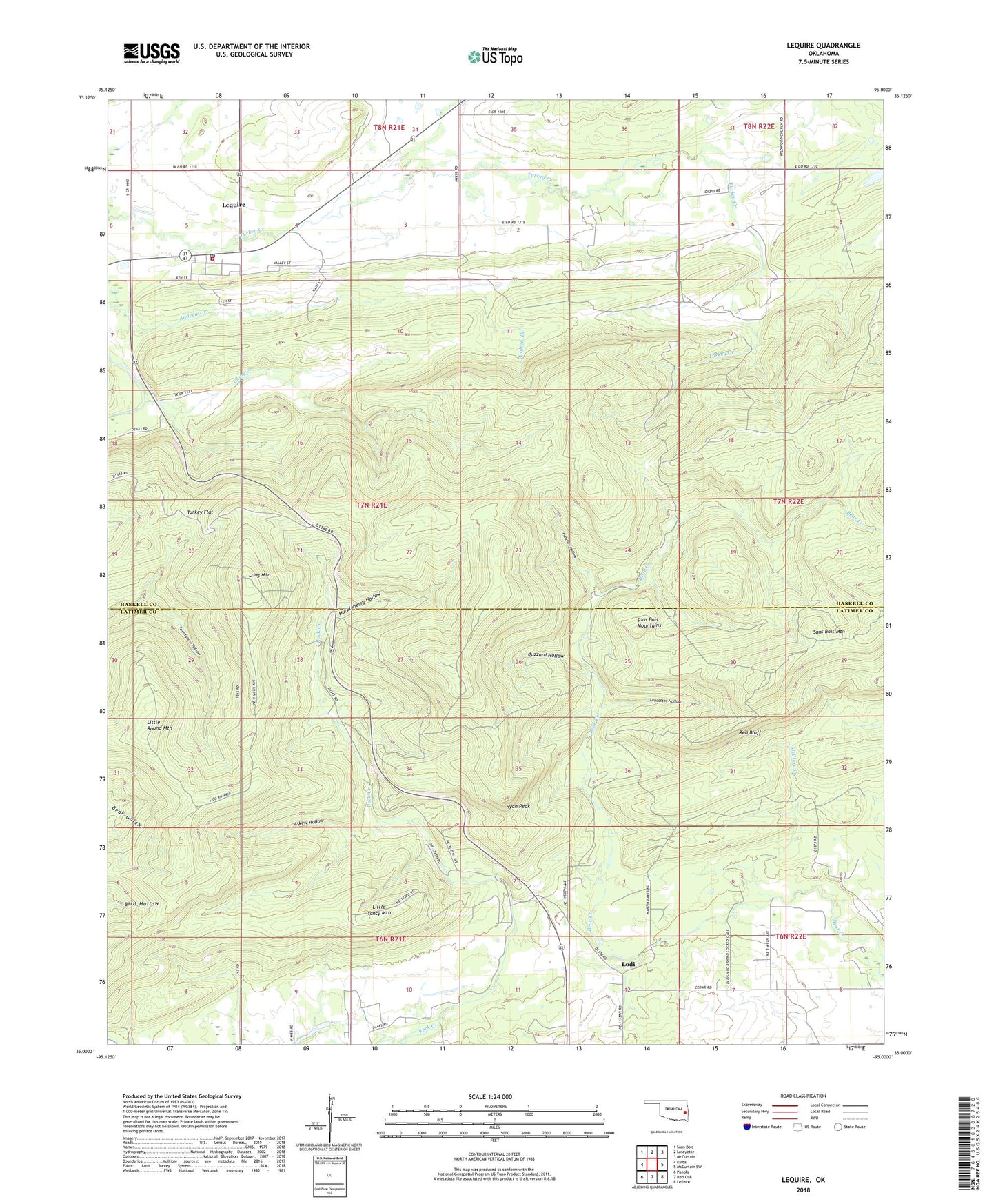
2018 topographic map quadrangle Lequire in the state of Oklahoma. Scale: 1:24000. Based on the newly updated USGS 7.5' US Topo map series, this map is in the following counties: Latimer, Haskell. The map contains contour data, water features, and other items you are used to seeing on USGS maps, but also has updated roads and other features. This is the next generation of topographic maps. Printed on high-quality waterproof paper with UV fade-resistant inks.
Quads adjacent to this one:
West: Kinta
Northwest: Sans Bois
North: Lafayette
Northeast: McCurtain
East: McCurtain SW
Southeast: Leflore
South: Red Oak
Southwest: Panola
Contains the following named places: Askew Hollow, Buzzard Hollow, Cowden Laterals Site 12 Dam, Cowden Laterals Site 12 Reservoir, Eaton Creek, Huckleberry Hollow, Lancaster Hollow, Lequire, Lequire Census Designated Place, Lequire Post Office, Lequire Volunteer Fire Department, Little Round Mountain, Little Yancy Mountain, Lodi, Long Mountain, McClure Creek, Oknoname 361001 Dam, Oknoname 361001 Reservoir, Panther Hollow, Red Bluff, Ryan Peak, Township of Diamond, Turkey Flat, ZIP Code: 74943