MyTopo
Eason Oklahoma US Topo Map
Couldn't load pickup availability
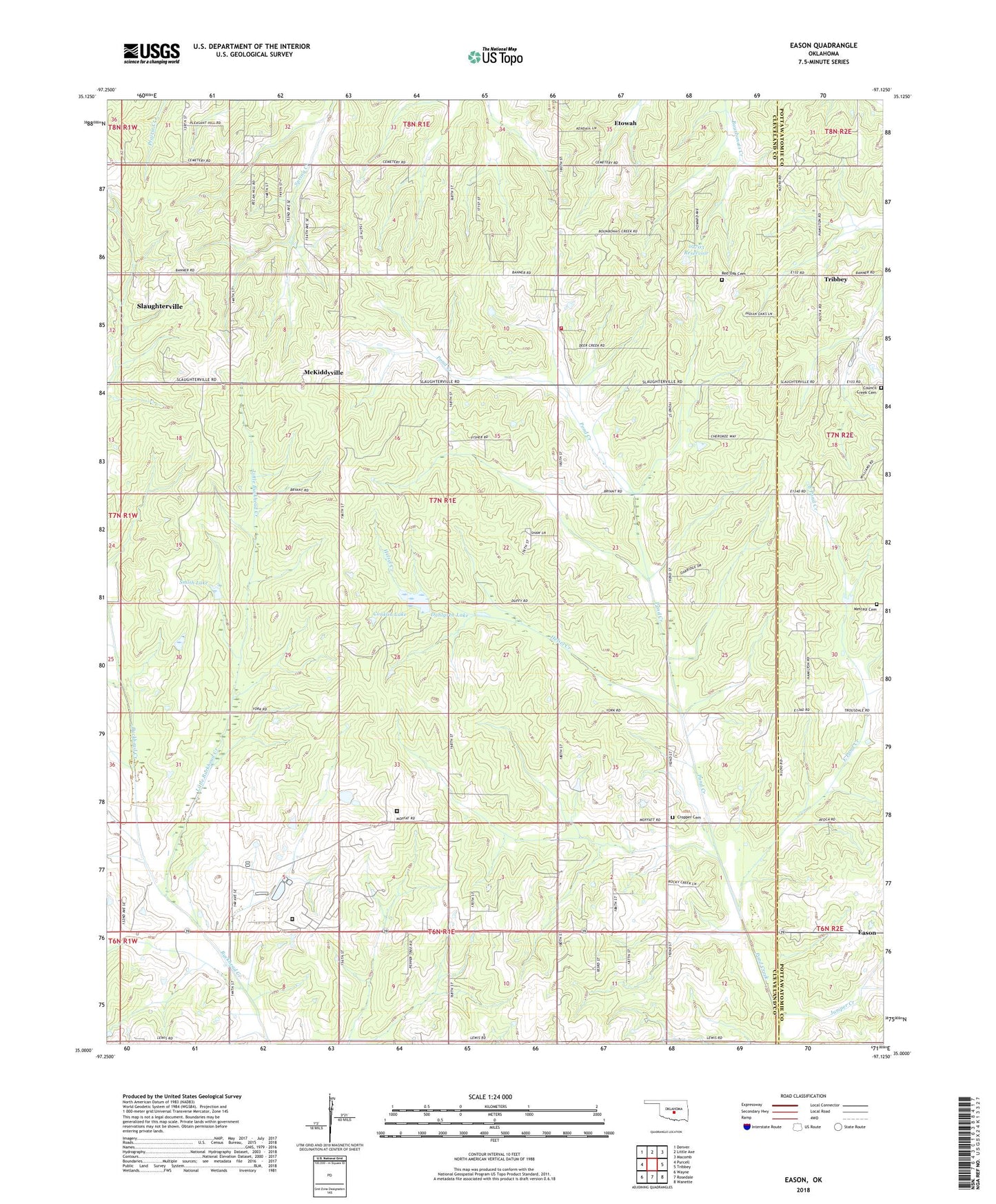
2022 topographic map quadrangle Eason in the state of Oklahoma. Scale: 1:24000. Based on the newly updated USGS 7.5' US Topo map series, this map is in the following counties: Cleveland, Pottawatomie. The map contains contour data, water features, and other items you are used to seeing on USGS maps, but also has updated roads and other features. This is the next generation of topographic maps. Printed on high-quality waterproof paper with UV fade-resistant inks.
Quads adjacent to this one:
West: Purcell
Northwest: Denver
North: Little Axe
Northeast: Macomb
East: Tribbey
Southeast: Wanette
South: Rosedale
Southwest: Wayne
This map covers the same area as the classic USGS quad with code o35097a2.
Contains the following named places: Cedar Country Fire Protection District Headquarters, Conklin Lake, Council Creek Cemetery, Cropper Cemetery, Dahlgren Lake, Dahlgrin Lake Dam, Eason, East Pond Creek, Griffin Memorial Hospital Annex, Helsel Creek, Joseph Harp Correctional Center, Jumper Creek, Lexington Assessment and Reception Center, Lexington Wildlife Managment Area, Little Buckhead Creek, McKiddyville, Metcalf Cemetery, Muldrow Airfield Heliport, Muldrow Army Heliport, Oknoname 02703 Dam, Oknoname 02703 Reservoir, Red Oak Cemetery, Rose Hill Church, Rose Hill School, Shiloh Church, Smith Lake, Spring Creek School, Township of Canadian, ZIP Code: 73051