MyTopo
Minco Oklahoma US Topo Map
Couldn't load pickup availability
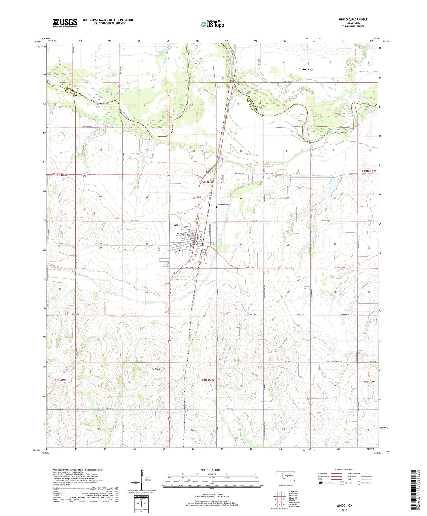
2018 topographic map quadrangle Minco in the state of Oklahoma. Scale: 1:24000. Based on the newly updated USGS 7.5' US Topo map series, this map is in the following counties: Grady, Canadian. The map contains contour data, water features, and other items you are used to seeing on USGS maps, but also has updated roads and other features. This is the next generation of topographic maps. Printed on high-quality waterproof paper with UV fade-resistant inks.
Quads adjacent to this one:
West: Cogar SE
Northwest: Cogar NE
North: Union City
Northeast: Minco NE
East: Tuttle
Southeast: Chickasha NE
South: Pocasset
Southwest: Anadarko NE
Contains the following named places: Buggy Creek, Church of Christ, City of Minco, Evergreen Cemetery, First Baptist Church, Methodist Church, Minco, Minco Division, Minco Elementary School, Minco Fire Department, Minco High School, Minco Middle School, Minco Police Department, Minco Post Office, Oknoname 051026 Dam, Oknoname 051026 Reservoir, Red Hill, Township of Union