MyTopo
Minco NE Oklahoma US Topo Map
Couldn't load pickup availability
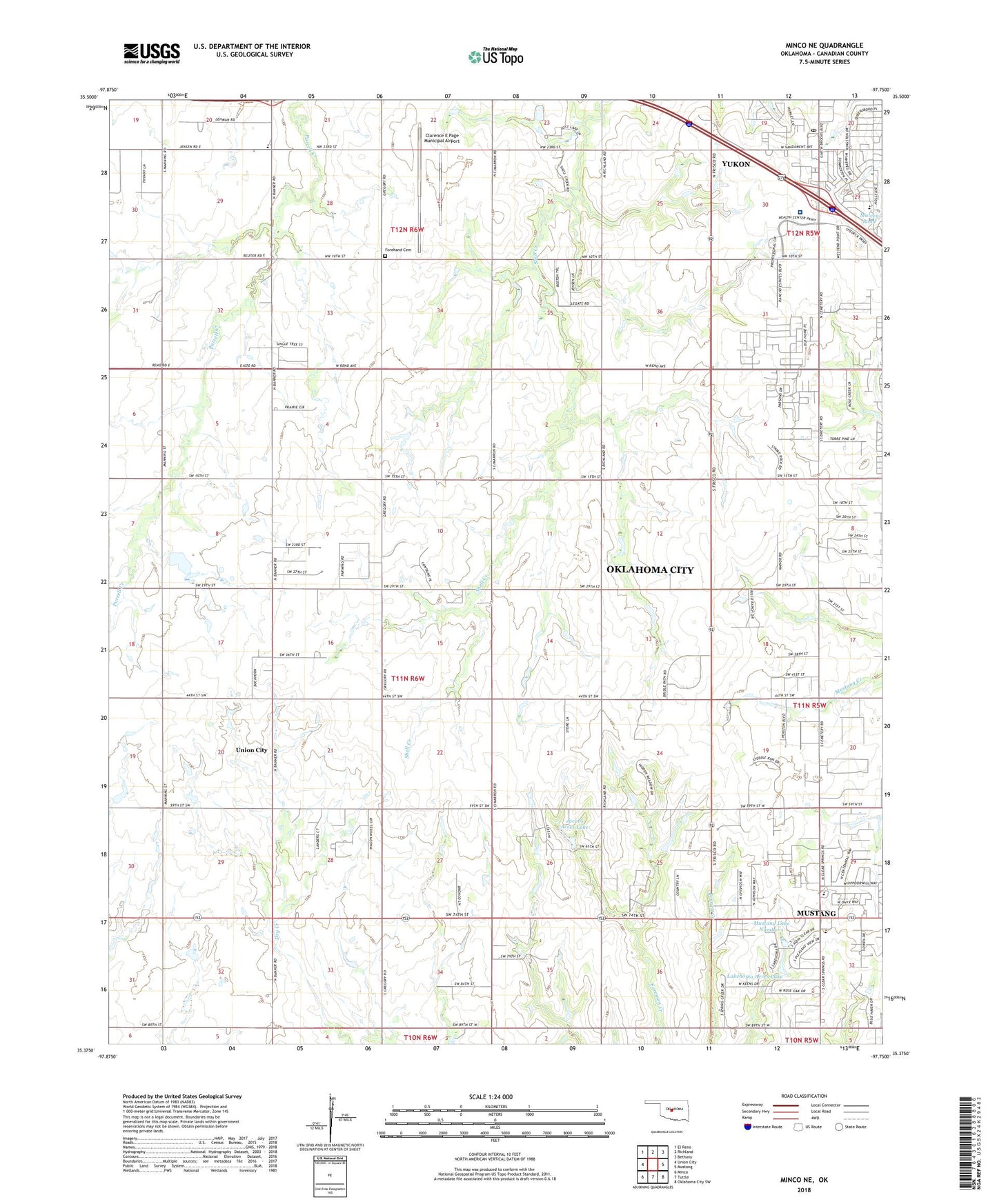
2022 topographic map quadrangle Minco NE in the state of Oklahoma. Scale: 1:24000. Based on the newly updated USGS 7.5' US Topo map series, this map is in the following counties: Canadian. The map contains contour data, water features, and other items you are used to seeing on USGS maps, but also has updated roads and other features. This is the next generation of topographic maps. Printed on high-quality waterproof paper with UV fade-resistant inks.
Quads adjacent to this one:
West: Union City
Northwest: El Reno
North: Richland
Northeast: Bethany
East: Mustang
Southeast: Oklahoma City SW
South: Tuttle
Southwest: Minco
This map covers the same area as the classic USGS quad with code o35097d7.
Contains the following named places: Banner Elementary School, Chisholm Church, Chisholm Shopping Center, Chisholm Trial United Presbyterian Church, Clarence E Page Municipal Airport, Forehand Cemetery, Integris Canadian Valley Hospital, Jacobs Acres Dam, Jacobs Acres Lake, Lakehoma Acres Dam, Lakehoma Acres Lake, Lakehoma Church, Mid High School, Mulvey Pond Dam, Mustang Education Center, Mustang Lake Number 1, Mustang Lakehoma Elementary School, Mustang Number 1 Dam, Resurrection Lutheran Church, Shedeck Elementary School, Trinity Baptist Church of Yukon, West Point Church, Yukon Post Office