MyTopo
Mount Scott Oklahoma US Topo Map
Couldn't load pickup availability
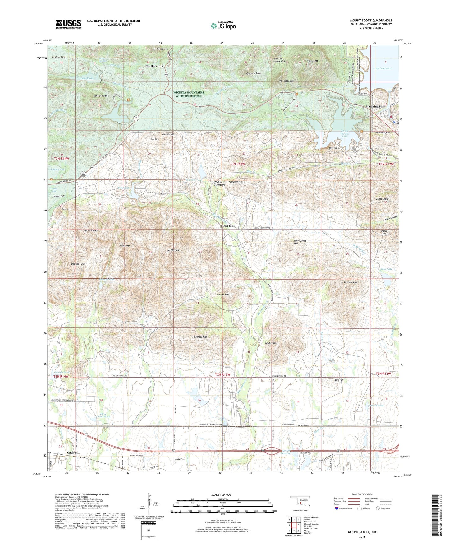
2022 topographic map quadrangle Mount Scott in the state of Oklahoma. Scale: 1:24000. Based on the newly updated USGS 7.5' US Topo map series, this map is in the following counties: Comanche. The map contains contour data, water features, and other items you are used to seeing on USGS maps, but also has updated roads and other features. This is the next generation of topographic maps. Printed on high-quality waterproof paper with UV fade-resistant inks.
Quads adjacent to this one:
West: Quanah Mountain
Northwest: Saddle Mountain
North: Meers
Northeast: Richards Spur
East: Fort Sill
Southeast: Lawton
South: Taupa
Southwest: Post Oak Creek
This map covers the same area as the classic USGS quad with code o34098f5.
Contains the following named places: Arapaho Point, Browne Hill, Cache Cemetery, Carlton Mountain, Central Peak, City of Cache, Costain Hill, Craterville Park, Cross Mountain, Davidson Hill, Elmer Thomas Lake, Elmer Thomas Lake Dam, Engineer Pond, Fern Mountain, Fort Sill, Graham Flat, Gruber Hill, Holy City Church, Hunting Horse Hill, Indian Hill, Jed Flat, Jed Johnston Lake Dam, Kerr Hill, Ketch Lake, Ketch Lake Dam, Ketch Ranch, Koehler Hill, Komah Memorial Church, KVRS-FM (Lawton), Lake Jed Johnson, Lake Lawtonka, Lake Rush, Lawton Dam, Lawtonka Dam, Letra Campground and Picnic Area, Little Medicine Creek, Logan Lake, Medicine Park, Medicine Park Fire Department, Medicine Park Police Department, Medicine Park Post Office, Mount McKinley, Mount Scott, Mount Scott Picnic Area, Mount Scotts Boy, Mount Sherman, Newt Jones Hill, Oknoname 031038 Dam, Oknoname 031038 Reservoir, Osceola Pond, Pratt Hill, Quanah Lake, Quanah Parker Lake Dam, Quetone Point, Running Deer Girl Scout Camp, Rush Lake Dam, Sulphur Flat, Tank X Pond, The Holy City, Thompson Hill, Three Crows Pond, Township of Quanna, Turtle Springs, West Lake