MyTopo
Saddle Mountain Oklahoma US Topo Map
Couldn't load pickup availability
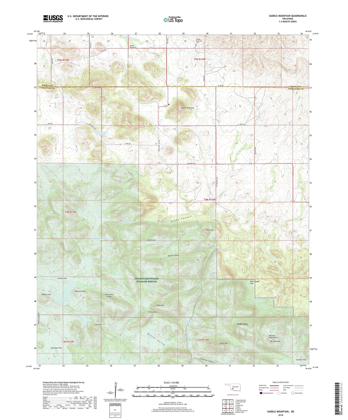
2022 topographic map quadrangle Saddle Mountain in the state of Oklahoma. Scale: 1:24000. Based on the newly updated USGS 7.5' US Topo map series, this map is in the following counties: Comanche, Kiowa. The map contains contour data, water features, and other items you are used to seeing on USGS maps, but also has updated roads and other features. This is the next generation of topographic maps. Printed on high-quality waterproof paper with UV fade-resistant inks.
Quads adjacent to this one:
West: Cooperton
Northwest: Unap Mountain
North: Bally Mountain
Northeast: Alden
East: Meers
Southeast: Mount Scott
South: Quanah Mountain
Southwest: Odetta
This map covers the same area as the classic USGS quad with code o34098g6.
Contains the following named places: Antelope Flat, Black Bear Spring, Blue Mountain, Cedar Mountain, Cold Spring, Comanche Lake, Comanche Lake Dam, Elk Pass, Geronimo Ridge, Grama Flat, Grama Lake, Gramma Lake Dam, Gray Wolf Crossing, Gray Wolf Spring, Greenleaf Canyon, Harrington Spring, Hobbs Canyon, Hollis Pond, Hourigan Spring, Kiowa Lake, Kiowa Lake Dam, Medicine Tank, Moko Mountain, Moose Canyon, Mount Lauramac, North Mountain, Oknoname 123006 Dam, Oknoname 123006 Reservoir, Pearl Mountain, Rain Gauge Flat, Saddle Mountain, Saddle Mountain Cemetery, Saddle Mountain Fire Department, Saddle Mountain Indian Mission, Soldiers Dam, Spencer Creek, Township of Saddle Mountain, Turkey Pass, Whistle Peak, Wichita Mountains, Wichita Mountains Wilderness (North Mountain Unit), Wichita Mountains Wildlife Refuge, Winter Valley, ZIP Code: 73507