MyTopo
Muldrow SW Oklahoma US Topo Map
Couldn't load pickup availability
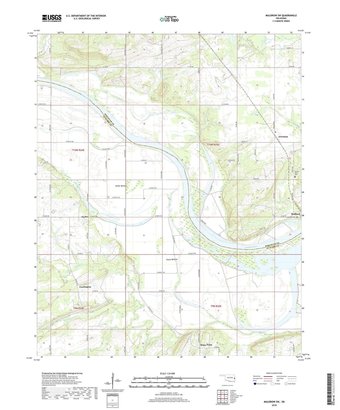
2018 topographic map quadrangle Muldrow SW in the state of Oklahoma. Scale: 1:24000. Based on the newly updated USGS 7.5' US Topo map series, this map is in the following counties: Le Flore, Sequoyah. The map contains contour data, water features, and other items you are used to seeing on USGS maps, but also has updated roads and other features. This is the next generation of topographic maps. Printed on high-quality waterproof paper with UV fade-resistant inks.
Quads adjacent to this one:
West: Robert S Kerr Dam
Northwest: Sallisaw
North: Gans
Northeast: Muldrow
East: Fort Coffee
Southeast: Spiro
South: Panama
Southwest: Bokoshe
Contains the following named places: Cache Bottom, Cache Creek, Center Point Cemetery, Coal Creek, Cowlington, Foreman, Little Skin Creek, Onion Creek, Pecan Creek, Redbank Creek, Redland Cemetery, Redland Fire Department, Spiro Division, Stony Point, Township of Redland, Township of Spiro, Tucker, Tucker Bottom, Tucker Lake