MyTopo
Spiro Oklahoma US Topo Map
Couldn't load pickup availability
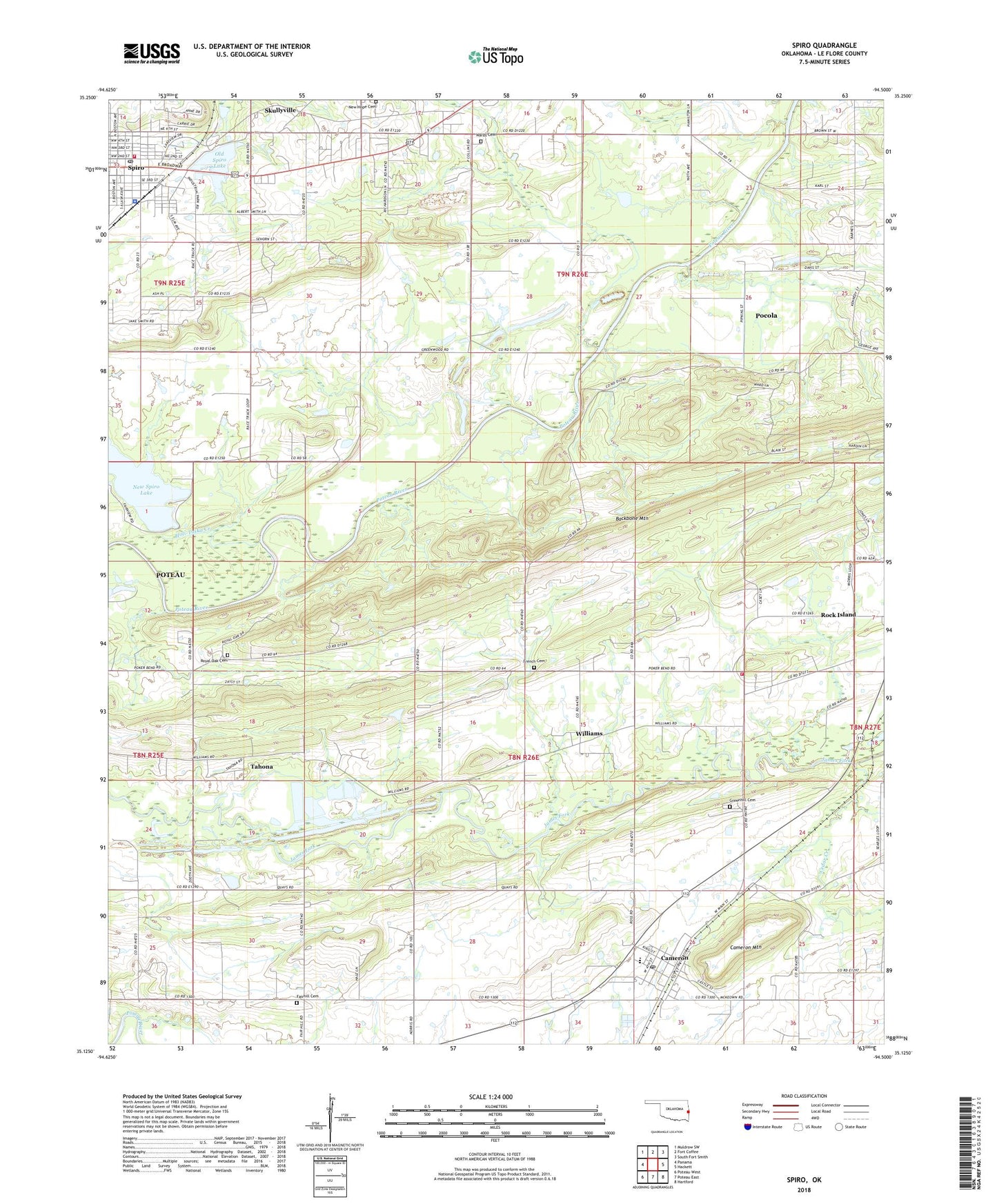
2022 topographic map quadrangle Spiro in the state of Oklahoma. Scale: 1:24000. Based on the newly updated USGS 7.5' US Topo map series, this map is in the following counties: Le Flore. The map contains contour data, water features, and other items you are used to seeing on USGS maps, but also has updated roads and other features. This is the next generation of topographic maps. Printed on high-quality waterproof paper with UV fade-resistant inks.
Quads adjacent to this one:
West: Panama
Northwest: Muldrow SW
North: Fort Coffee
Northeast: South Fort Smith
East: Hackett
Southeast: Hartford
South: Poteau East
Southwest: Poteau West
This map covers the same area as the classic USGS quad with code o35094b5.
Contains the following named places: Cameron, Cameron Elementary School, Cameron High School, Cameron Mountain, Cameron Post Office, Cedar Creek, Christian Grove Church, Emergency Medical Services of Le Flore County Station 5 Spiro, Fair Hill Church, Fairhill Cemetery, First Baptist Church, French Cemetery, Green Hill Church, Greenhill Cemetery, Hog Eye Volunteer Fire Department, Holi-Tuska Creek, Lakeview Baptist Church, Murry Spur Church, New Hope Garden of Memories Cemetery, New Spiro Lake, New Spiro Lake Dam, Old Spiro Lake, Old Spiro Lake Dam, Royal Oak Cemetery, Royal Oak Church, Skullyville, Spiro, Spiro Fire Department, Spiro Police Department, Spiro Post Office, Tahona, Town of Cameron, Town of Spiro, Township of Cameron, United Methodist Church, Wards Cemetery, Williams, ZIP Code: 74932