MyTopo
Fort Coffee Oklahoma US Topo Map
Couldn't load pickup availability
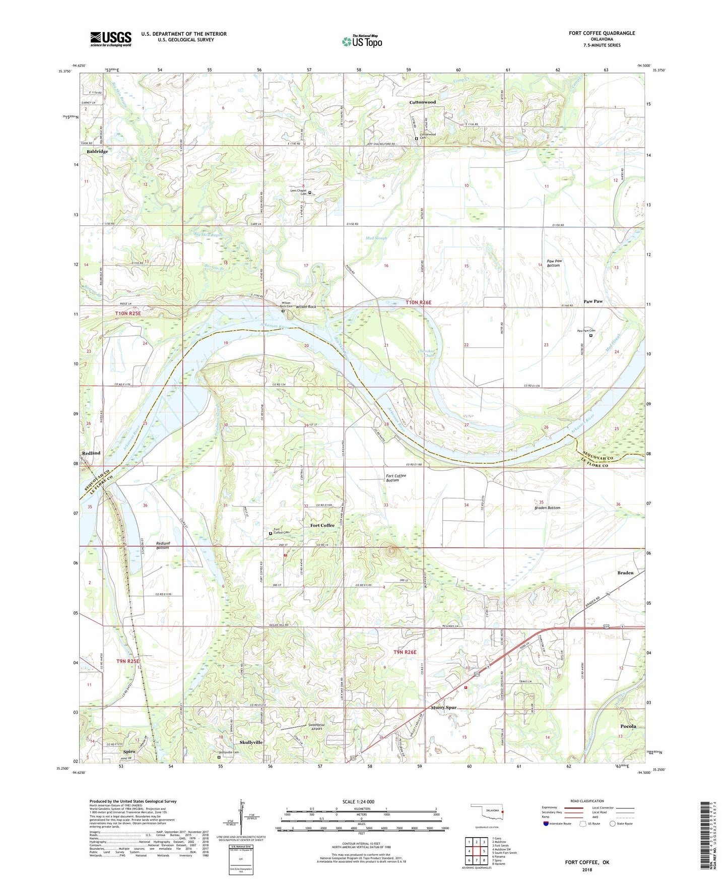
2022 topographic map quadrangle Fort Coffee in the state of Oklahoma. Scale: 1:24000. Based on the newly updated USGS 7.5' US Topo map series, this map is in the following counties: Le Flore, Sequoyah. The map contains contour data, water features, and other items you are used to seeing on USGS maps, but also has updated roads and other features. This is the next generation of topographic maps. Printed on high-quality waterproof paper with UV fade-resistant inks.
Quads adjacent to this one:
West: Muldrow SW
Northwest: Gans
North: Muldrow
Northeast: Fort Smith
East: South Fort Smith
Southeast: Hackett
South: Spiro
Southwest: Panama
This map covers the same area as the classic USGS quad with code o35094c5.
Contains the following named places: Baldridge, Barrow Branch, Big Skin Bayou, Braden, Braden Bottom, Cherokee Chute, Cottonwood, Cottonwood Cemetery, Deadman Slough, Fort Coffee, Fort Coffee Bottom, Fort Coffee Cemetery, Fort Coffee Volunteer Fire Department, Fox Branch, Lees Chapel, Lees Chapel Cemetery, Macedonia Church, Mud Slough, Murry Spur, Murry Spur Volunteer Fire Department, Oak Lodge Church, Paw Paw, Paw Paw Bottom, Paw Paw Cemetery, Paw Paw Chapel, Rabbit Branch, Redland, Redland Bottom, Site of Old Fort Coffee, Skullyville Cemetery, Sweetbriar Airport, Town of Fort Coffee, Township of Braden, Township of Paw Paw, W.D. Mayo Lock and Dam, Wells Creek, Wilson Rock, Wilson Rock Cemetery, ZIP Code: 74959