MyTopo
Muldrow Oklahoma US Topo Map
Couldn't load pickup availability
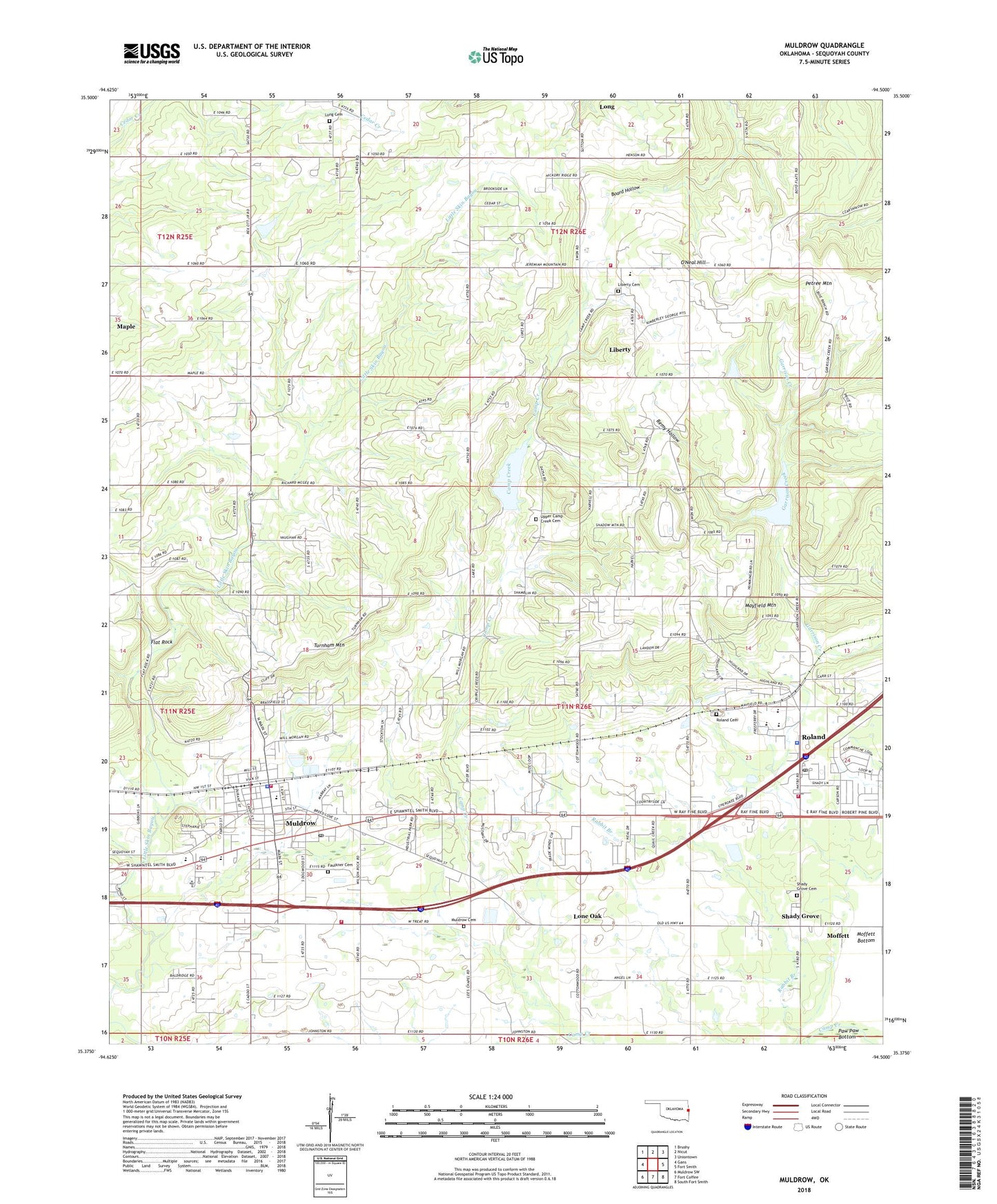
2018 topographic map quadrangle Muldrow in the state of Oklahoma. Scale: 1:24000. Based on the newly updated USGS 7.5' US Topo map series, this map is in the following counties: Sequoyah. The map contains contour data, water features, and other items you are used to seeing on USGS maps, but also has updated roads and other features. This is the next generation of topographic maps. Printed on high-quality waterproof paper with UV fade-resistant inks.
Quads adjacent to this one:
West: Gans
Northwest: Brushy
North: Nicut
Northeast: Uniontown
East: Fort Smith
Southeast: South Fort Smith
South: Fort Coffee
Southwest: Muldrow SW
Contains the following named places: Faulkner Cemetery, Flat Rock, Holiness Church, Liberty, Liberty Area Volunteer Fire Association, Liberty Cemetery, Liberty Census Designated Place, Liberty Community, Liberty Elementary School, Lone Oak, Long, Long Cemetery, Long Census Designated Place, Mayfield Mountain, Mineral Springs Church, Moffett Bottom, Muldrow, Muldrow Cemetery, Muldrow Dam, Muldrow Elementary School, Muldrow Fire Department Station 1, Muldrow Fire Department Station 2, Muldrow High School, Muldrow Lake, Muldrow Middle School, Muldrow Police Department, Muldrow Post Office, Oknoname 135003 Dam, Oknoname 135003 Reservoir, O'Neal Hill, Pafford Emergency Medical Services Muldrow Substation, Petree Mountain, Remy, Remy Hollow, Roland, Roland Cemetery, Roland Elementary School, Roland Fire Department, Roland High School, Roland Junior High School, Roland Police Department, Roland Post Office, Shady Grove, Shady Grove Baptist Church Cemetery, Town of Muldrow, Town of Roland, Township of Muldrow, Township of Roland, Turnham Mountain, Upper Camp Creek Cemetery, Woodland Hills Church, ZIP Codes: 74948, 74954