MyTopo
Peggs Oklahoma US Topo Map
Couldn't load pickup availability
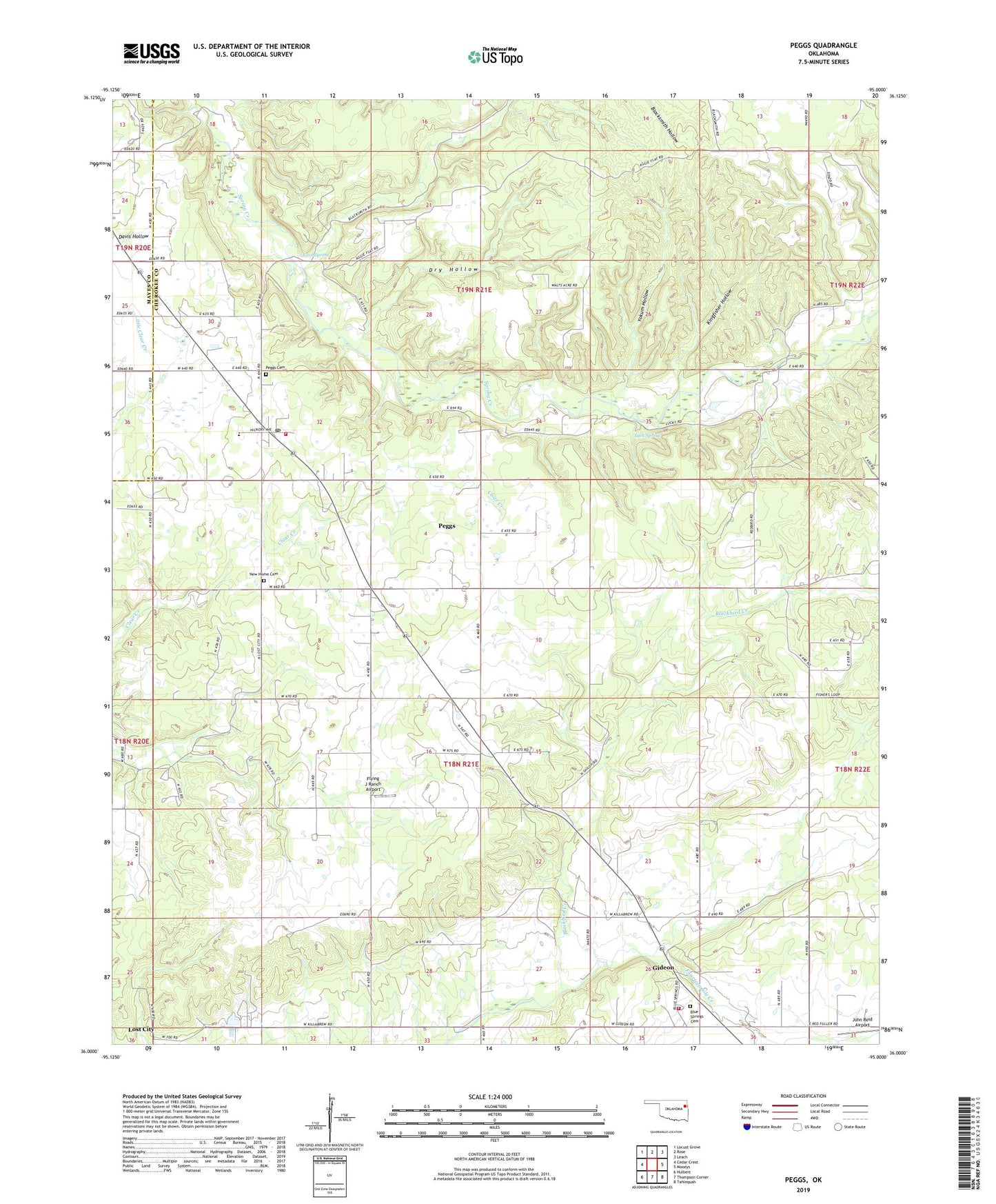
2019 topographic map quadrangle Peggs in the state of Oklahoma. Scale: 1:24000. Based on the newly updated USGS 7.5' US Topo map series, this map is in the following counties: Cherokee, Mayes. The map contains contour data, water features, and other items you are used to seeing on USGS maps, but also has updated roads and other features. This is the next generation of topographic maps. Printed on high-quality waterproof paper with UV fade-resistant inks.
Quads adjacent to this one:
West: Cedar Crest
Northwest: Locust Grove
North: Rose
Northeast: Leach
East: Moodys
Southeast: Tahlequah
South: Thompson Corner
Southwest: Hulbert
Contains the following named places: Blackbird Creek, Blue Springs Cemetery, Blue Springs Church, Cave Spring, Clear Creek Church, Dry Hollow, Flying J Ranch Airport, Gideon, Gideon Volunteer Fire Department Station 1, John Reid Airport, Kingfisher Hollow, Lost City, Lost City Census Designated Place, Luck Spring, New Home Cemetery, New Home Church, Parris Church, Peggs, Peggs Cemetery, Peggs Census Designated Place, Peggs Community, Peggs Elementary School, Peggs Post Office, Peggs Volunteer Fire Department, Township of Peggs, Yokum Hollow, ZIP Code: 74452